Too Cool Guts & Glory 2015 Race Report
September 5, 2015Glorieta Camp, New Mexico
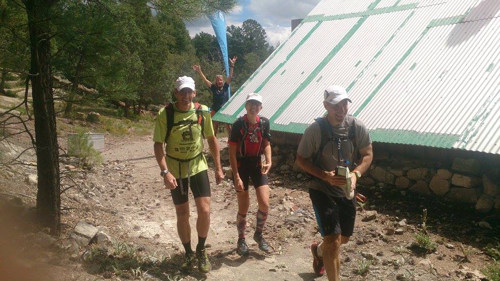
by David Bogle
|
I have been racing at Too Cool's events for more than 10 years now. I have always enjoyed their races, but since they have limited venues, we have been racing on the same ground for many of the past years. This race would be new. It was in New Mexico near Santa Fe. Glorieta Camp is now part of the Camp Eagle family and they have wasted no time adding all kinds of fun things to do. The really nice thing is that the camp is on the southern tip of a portion of the Santa Fe National Forest with endless acres of fresh wilderness.
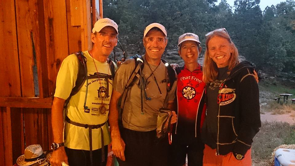
It was a long drive, about 10 hours from Austin. Our team for this one would be Sheila Torres-Blank, Tom Lane and myself (David Bogle). We have all raced together at times over the years, but typically we race against each other. It was going to be fun to team up and race together. When we arrived to camp it was raining but nice and cool. None of our team had ever been here before and we had not looked at any maps of the area. We decided it would be fun to just race this one without doing any kind of map studying beforehand to see how we could do going in to the event "blind".
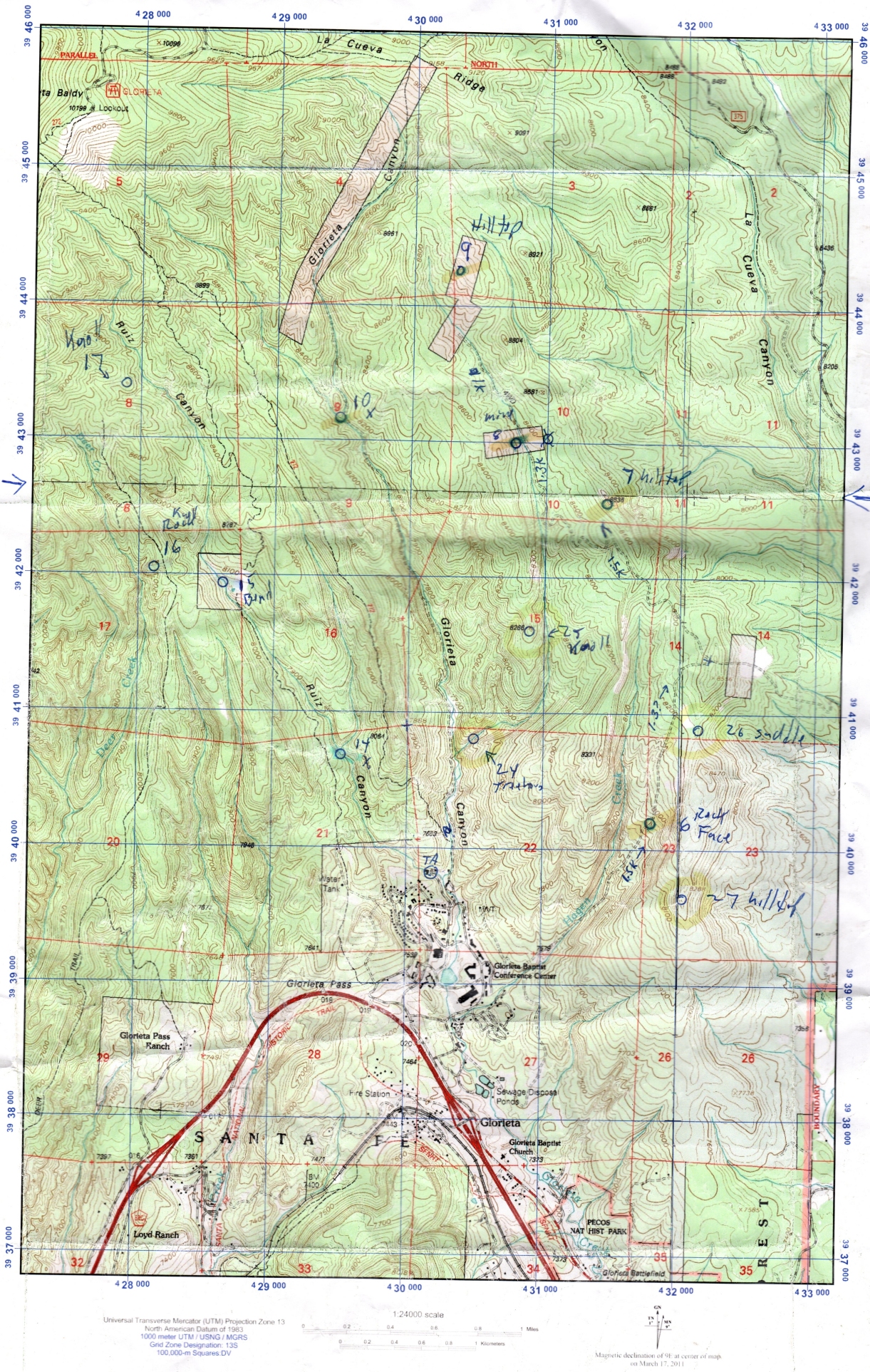
Race morning was nice and cool. There would be two races: A twelve-hour version and a shorter sprint race (we would tackle the 12 hour version). Both races would start at the same time. A couple hours prior to the start, we were given the race maps and most of the checkpoint coordinates. We quickly plotted all the points and started considering a race strategy. It was unclear if we would be able to get all the CPs before race cutoff, so we made a few notes about points we might cut off if we were low on time.
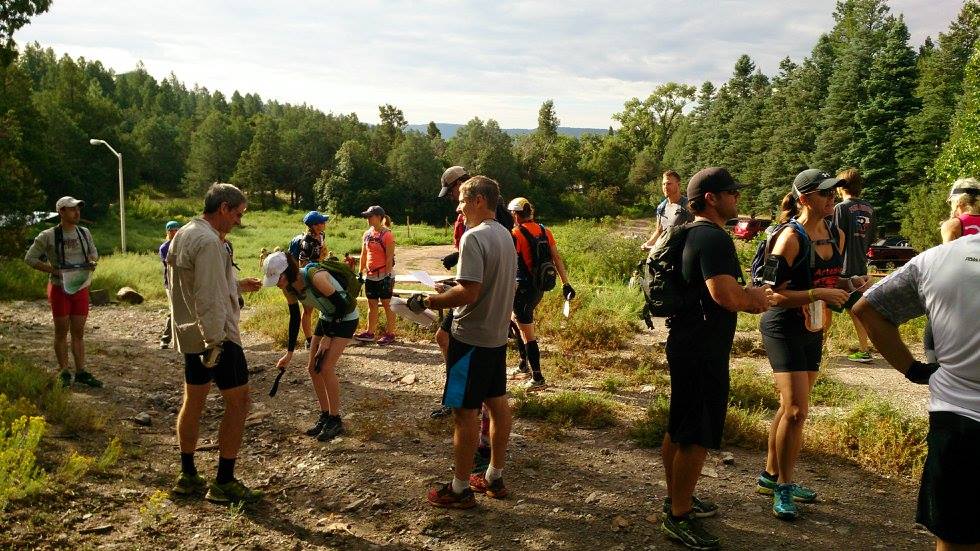
The start of the race was to be a scramble around the camp. All the points had a "special test" to complete. We quickly decided that we would skip the closest point and head straight to the ropes section. (There is almost always a wait at ropes.) Before Robyn said start, we were all handed a piece of paper. At go, we were told to open it, complete the instructions, and then we could go. Turns out, it was a word search/elimination puzzle. The good news was that we also frequently do clue solving races, so this was a familiar format for us. We were the first team to complete the puzzle and take off running.
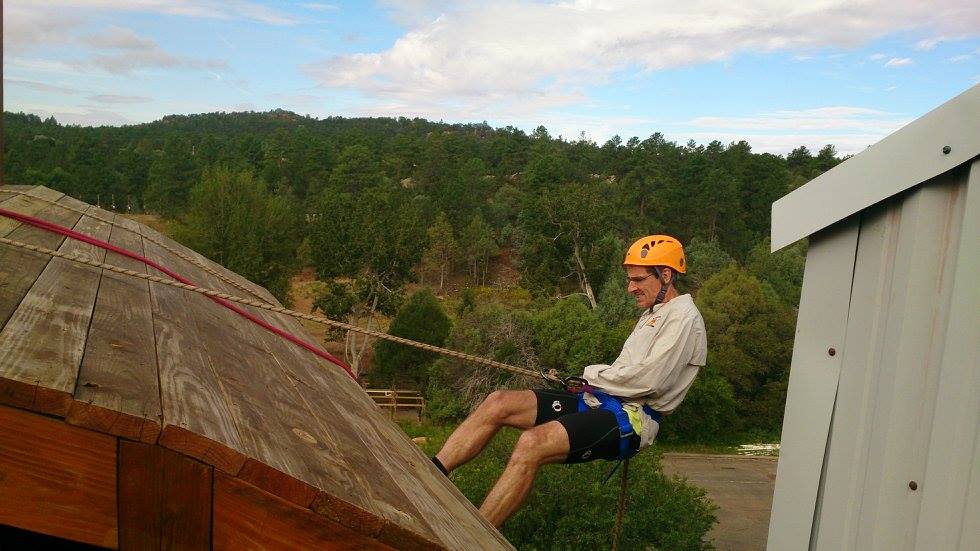
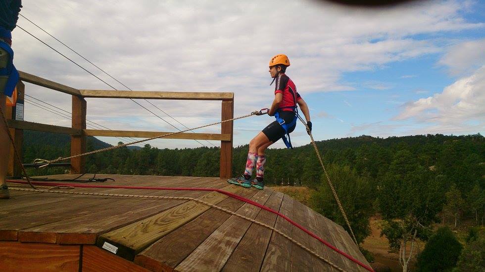
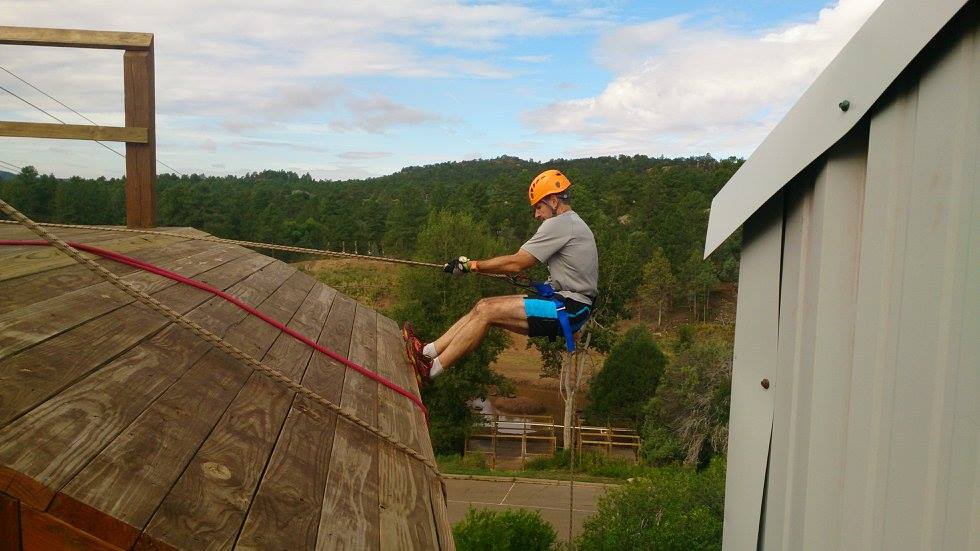
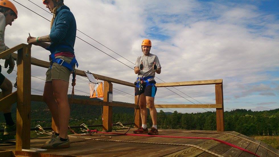
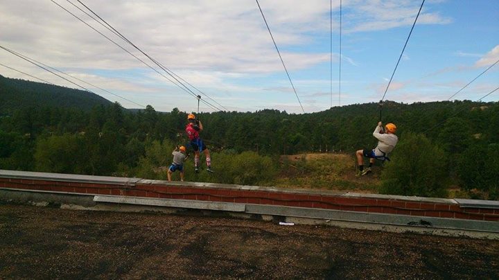
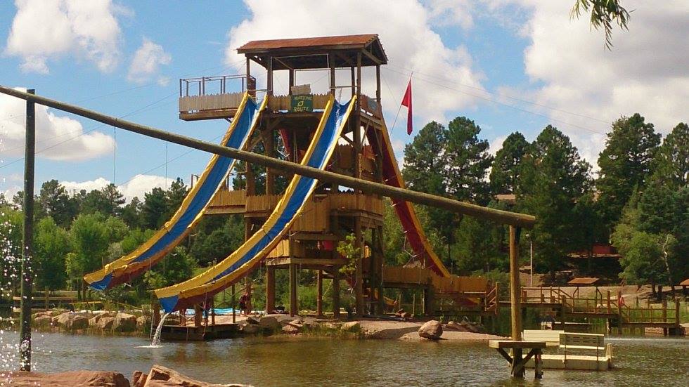
We stuck to our strategy and went directly to the ropes. We ran up to the top of the stairs, only to be told to go back all the way back to bottom to get our ropes gear. So down we went, we got geared up, and then back to the top. I think the camp people were a bit unfamiliar with the pace we wanted to go, but being safe is important. First up, we did a rappel, then back up the stairs to the top for a zip line.
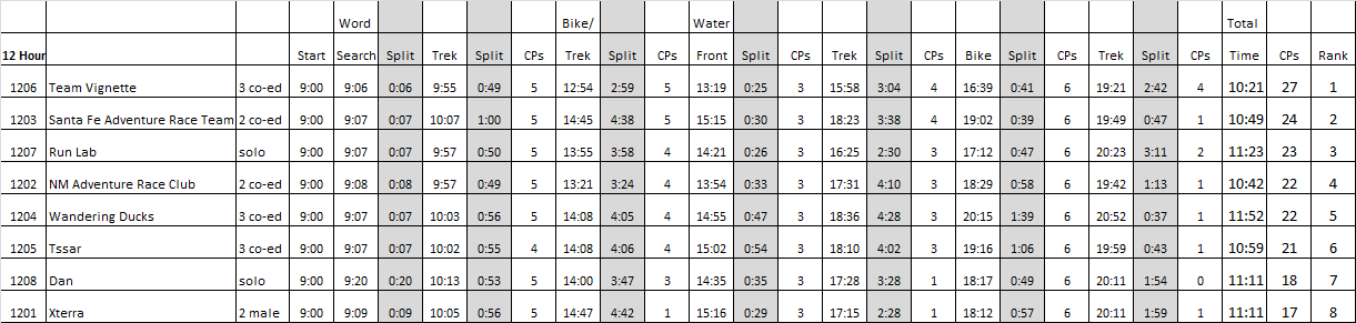
Next we hit the pump track where we rode downhill scooters around a circuit. Fun! The next point was at the Glorieta Overlook. There was a nice view from up there. We would have many more nice views before the day ended. Our final point on this leg would be a cool throwback ride on adult size big-wheel trikes. We had to ride down a hill, skid around a 180 degree turn, and back up the hill. Done with leg 1, we checked into TA, got the passport for the next leg of the race, and were off. Up next would be a long mountain bike leg. On this leg was one of the most ideal points to potentially skip in this race. It was far off by itself. We did not know most of the other teams, but there were some solid looking groups, so we were unsure what the right strategy would be. (The team with the most points wins, but you have to finish within 12 hours). Off on the bikes we left. We were the first team to start the leg, but were closely followed by a couple others. On the first trail, I was slightly unsure if we were on the right trail, so I had us stop and verify the road we were on. This allowed a team of two guys and the solo team of Kim Mullens to pass us on bikes. Satisfied we were heading the right direction we continued on (we had been going the right way initially). We could see the other two teams just in front of us, but we would be steadily climbing for quite a long way so there was no need to kill ourselves trying to catch them. I hoped we could just out-navigate the other teams as the race went on. Our team was quite well stacked in that all three of us are solid navigators so I knew we should be OK in navigation if we just did our own thing. CP 6 was at a rock face, according to the given clue. There was no distinct map feature for it, so we just kept track of our distance traveled. The other two teams were stopped as we biked up to the area. It was quite clear that this was the right place as there was a couple of large rock knolls. We found the flag a few minutes later and journeyed on. All three teams were pretty much together at this stage. I was waiting for an intersection to verify our position, but we never saw it. A bit later, both other teams stopped just in front of us and I was slightly confused as well as we had hit a road intersection but not where I would have figured. A quick look at the maps and we knew where we were so we carried on. The two person male team chose the other direction, and Kim stayed behind to look at her map. A few moments later the male team popped out in front of us again (it must have been a trail re-route). CP 7 was at the top of a very large hill. We had a very distinct turn on the map to indicate where we wanted to approach. I was a bit surprised when we got to it and the male team was not there. Oh well, we put our bikes just off the trail as Kim road up, but then she kept going. I was surprised at that, but later she told us she plotted CP 7 in the wrong place, which is why she kept going. We hiked up the steep hill, punched the CP, admired the distant views, and then headed back to our bikes. Next we biked to an old mine. The point was in the mine, so we all set off underground. It was in the second tunnel we explored, so we punched it and got back out. We did see the guy's bikes here, but never saw them, so we're not sure where they went. CP 9 was at a hilltop where the map showed the trail ending. The topographic maps in the US are often over 25 years old, so we have all learned to really pay close attention as things have usually changed a bit since the maps were made. It turns out this road did actually end close to where we thought it would. Up to the top of this hill, where we found a campsite of some sorts, punched the CP then back down. Whew, these tall hills are NOT what we are used to racing in Texas. It was decision time. CP10 was only about 1.5 km away, but there was no road or trail to get us from where we were to the CP, and there were some large hills and forest in our way. We were well ahead of our own self-imposed time cutoff, so we chose to just take our bikes cross-country. This is usually a miserable experience in Texas, but the wonderful woods here were relatively open, so it was no problem to push/carry our bikes through the forest. We were even able to ride them down a few slopes. Our bike-whack went exactly as planned and we popped out on a parallel road, which led us directly to CP 10 (which was well hidden just off the road at a stream crossing). With CP 10 punched, all we had to do was get back to TA. The great news was that it was all downhill. We flew back into camp feeling like we had 100% nailed the navigation on that leg.
Next up was a fun swim leg on the water toys around camp. It was cold water and air temps were in the 60s so that kept us moving. We did a large waterslide, then a zip line into the water, and finally a blindfolded paddling course. With that leg done, it was back to TA. Robyn told us no one else had finished the bike leg yet, which we were happy to hear because that meant we had at least a 30-minute lead and no skipped CPs.
Next was the first significant trekking leg of the race. At the pre-race we were warned that CP 17 may be very tough to find if you are not spot on with navigation. We left camp using a camp trail map. It was not to scale and only roughly accurate (it was hand drawn). We were all sure it would take us very close to CP 14, which was at a creek intersection, but our plan was to just pay attention and if we saw the creek intersection we would get the point on the way out, and if we did not see it, we would grab that point on the way back. Sure enough, I figured out where we were as soon as we climbed in elevation away from the creek. We chose to not do any unnecessary down then back up, so we decided to save it for later. We took mental note of where we wanted to go into the woods for our return trip. Up the trail, we hit CP 15 just fine. We also found a huge shipping container in the middle of nowhere which we were told was a homemade sauna. A short bit of cross-country and we hit CP 16 just fine. We were really doing great on our team navigation, so we headed off in search of 17. We chose a careful approach strategy and nailed it right off. We had been going uphill all the way to this far CP, so now it was time to enjoy the downhill. We ran most of the downhill back and were very surprised to not come across any other teams until we were approaching CP 14, where we ran into team Santa Fe coming out of the creek. We punched CP 14, and then headed back into TA. In TA, Robyn told us only team Santa Fe had gotten all the CPs so far and we were a couple hours ahead. It was nice to know we had some breathing room. We were all really enjoying the cool weather and awesome scenery, so we kept moving at the same pace. The altitude and all the climbing did make this a heck of a lot tougher, but it was all fun. It was time for a camp trail biking leg. This was mostly all on the camp mountain bike trails. We chose a route that was basically clockwise. We would do the long climb on an old jeep road so we could descend back into camp on single track. Wow, that was fun! The single track was really a blast and I think we all had smiles coming back into TA. The final leg was another trek. In looking at the maps, this was almost all off road and navigation would be key. I had picked a route figuring we would be able to get to the first point in daylight but the remainder would be in the dark. We were well ahead of our estimates on time, but we kept the same route. CP 24 would be first. The hint was "treehouse", so we assumed there must be some sort of trail. Sheila did her thing and kept a pace count for us as she had been doing all day. At the creek turnoff where her pace count indicated, there was a super nice trail, which we took it and it led directly to the treehouse. I climbed to the top, punched the CP and came back down. Three points left and we still had a good bit of daylight. CP 25 was at the top of another big hill. We started heading up and for the first time, I was concerned about our navigation. The ridge was narrower than I anticipated. If we were on the wrong ridge, it was not too terrible, as they should eventually come together. So we kept going up, up, up... We finally stopped to let Tom and Sheila look closer at the maps. I carried on 50 meters or so up the hill. As I went uphill, the hill looked like what I expected. I came back down as Tom and Sheila did some triangulation and confirmed this was the right hill. We all kept going up and only 100 meters later we found our Checkpoint. Two to go. At this point, we had assumed it would be dark. I had planned to take us on a northeast course downhill to intersect the road, as that would be a safe route in the dark. But since it was still light we instead headed almost due east to cross through a saddle, and then went down to the road. We could even see both hills that defined the saddle for CP 26, so it was super easy to go punch that CP. One left. We followed the ridge south (avoiding the taller peaks), and that led us directly to CP 27. With that one punched, all we had to do was get back to the finish line. It was still light outside, and we could see the camp directly to the west. The map did show some pretty steep terrain between the camp and our location, but since it was daylight and downhill we figured we should go for it. With Tom leading, he found some great routes to get us down without getting cliffed out at any point. Even though we were quite sure we had a victory wrapped up as our navigation was just perfect the whole day, we all agreed to finish strong and ran most of the way back.
We were the first team back and wound up being the only team to clear the entire course. For those that missed it this year, mark your calendars for next year! This is a wonderful place to go race and escape the heat of summer! I will be back for sure in 2016.
|