Too Cool Spread Your Wings 2011 Race Report
May 28, 2011Rocksprings, Texas
by Kipley Fiebig
|
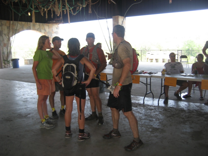
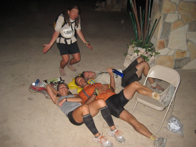
One of our favorite events every year is Too Cool's Spread Your Wings adventure race at Camp Eagle. The area has interesting contours to navigate on, lots of fun bike trails, and oodles of amazing special tests that you can't experience at any other race. Plus the volunteers from the camp are always universally friendly and upbeat. It's definitely worth the drive for this one! For this race Team Vignette was comprised of David Bogle, Jason Mittman, Julie Standing, and myself. Julie came to the event recovering from a leg/knee injury. It had been healing over the past month, and she figured it likely wouldn't bother her much during the race, but she warned us that she wanted to take things a bit easy just to be safe. We've all seen Julie race strong in the past with much worse injuries than this, so we weren't too worried about her. We arrived at Camp Eagle on Friday afternoon, set up a small TA area, and walked about looking at some of the new structures. There had been a lot of construction since the previous year, so there were new camp obstacles as well as new hotel-style rooms to sleep in. This camp just keeps getting better each year. We woke up early on Saturday morning, chowed down on some breakfast, and got ready for the big day. There would be 31 teams racing in the 18-hour version of the race, and dozens of other teams racing in one of the shorter versions that would be going on at the same time.
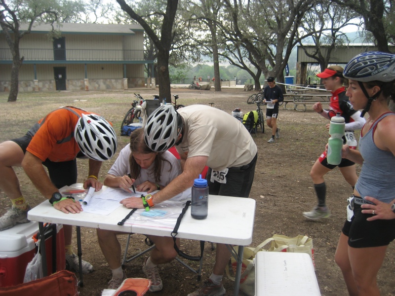
Leg 1 - "Scrambled Map" - TrekJust before the start teams were given a detailed map of Camp Eagle, which showed all the buildings and activity sites and such. To start the race the directors turned on some overhead projector screens that showed the locations of four different checkpoints. The overhead screens didn't display the full camp map, only small sections of the map that showed the area immediately surrounding each of the checkpoints, so we had to study our map and find the small sections to determine where the checkpoints were. Between the four of us we eventually spotted and marked the four destinations on our map. Some other teams had managed to circle the points on their maps and take off before us, but we still got out of there before the main mass of teams. We decided to collect the checkpoints in a counter-clockwise fashion, so we ran towards CP 2 first. We generally followed the waterline, then down the stairs by the zip line, then ran along the zip line to the Luau Site. There it was... CP 2. After that we cut due north, across the road and up the hillside. We accidentally got pulled off a bit to the east by a bunch of teams that seemed to be heading toward the point, but then we realized that those teams weren't going the right way, so we corrected ourselves and found CP 1 inside a wooden fort. We headed west along the jeep roads to find the natural amphitheater, where CP 3 was hidden in a bush. Then we hit the main road and followed it west, along the way high-fiving all the teams that had decided to visit the points in the clockwise direction. We started up the road towards the windmill, then quickly jumped off it to the left to find CP 4 hidden near the "3D Web". And that was that for the first leg, a nice fast fun jog to get things started. We headed back east to the transition area (TA) to see what was next.
Leg 2 - "Camp Fun!" - BikeThe next leg's instructions told us to bike around the camp to find six points, and do special tests at each to receive credit for them. Also, we had turned in a mini-passport at the end of leg 1 and received our main passport at the start of leg 2, so now the CP numbers started over at "1" again. There weren't any UTM numbers to plot these points, just descriptions, so we started trying to locate them on the camp map. Let's see, one clue sheet description was "Mudpit", but on the camp map there was something labeled "Mud Crater"... was that the same thing? Also, we thought we knew where "Terrain Park" should be, but on the map it was labeled "Mountain Board Course". It wasn't like Too Cool to be unclear about things like this, so we wondered if we were missing something. Sure enough, we were... we hadn't unrolled the second map that they'd just handed us, which was another copy of the Camp Eagle map, but it had all six bike points pre-plotted on it for us. Duh... we are idiots! Here we were trying to do things the hard way, by plotting them ourselves on the unmarked map!
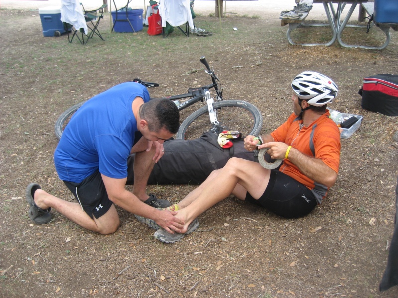
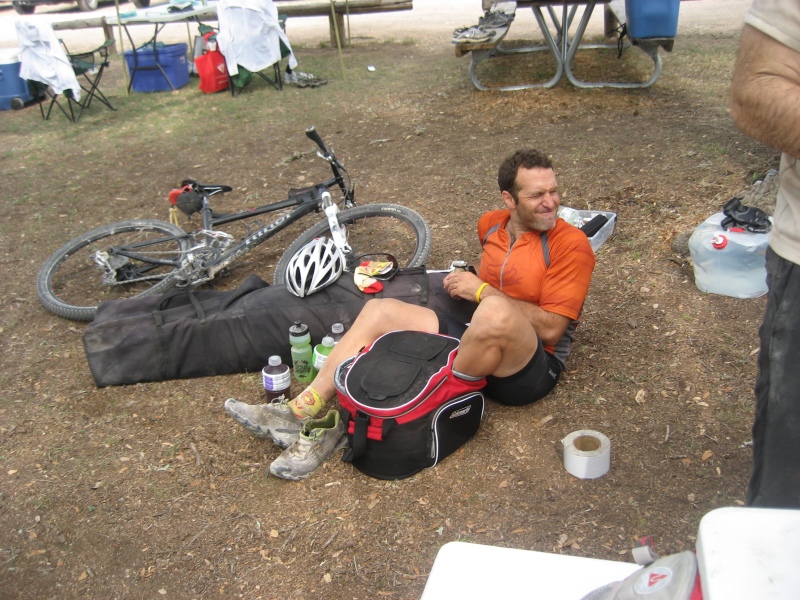
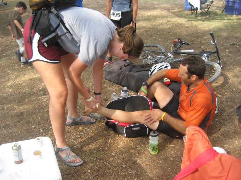
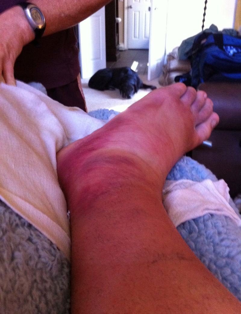
OK, let's shake off that temporary stupidity and get biking. We decided to do a counter-clockwise loop again, mainly because we'd noticed that CP 3 involved rock climbing, and we wanted to get there before a bottleneck formed. We dropped our bikes by the river edge, and hopped across the stones to get to the rock face on the other side. The volunteers there told us to put on harnesses and climbing helmets, and then we'd each take turns climbing up the rock, relay-style. The rock climbing was a bit tricky, but we eventually all made it to the top and rappelled back down. And then (imagine some scary dramatic music here...), while walking down the trail from the rock face back to our bikes, Jason suddenly stumbled and twisted his ankle. Was it serious? Yes, apparently it was. We asked Jason what he wanted to do, and he said we should keep on going, so we biked north to the CP 2 for the mountain boarding. Here our team was given a single kick-bike, and we had to take turns riding it down a hill over some small moguls, and then return back to the top along a jeep road. Dave took off for the first loop on the kick-bike, while Jason lay on the ground and asked Julie to pull his ankle back into place. Julie yanked hard on Jason's foot a couple times until he said he felt it pop back into position. Pretty scary stuff, but Jason made it clear that he felt he could continue. He at least wanted to finish this bike leg before getting the ankle checked out back in TA. So Julie and I did our kick-bike loops after Dave, and then Jason did his loop, trying not to put too much stress on his ankle. He still wanted to keep going, so we headed northeast to CP 4 at the rifle range. Jason had wanted the chance do the riflery this year since Dave got to do it last year, but we weren't about to make him walk a single unnecessary step on his ankle, so Dave got to shoot again. Maybe next year, Jason! After two shots to calibrate the rifle Dave hit all three of his required cans in a row, so we were quickly done with that test. We biked west to CP 6, the Mine Maze. Here one of us had to enter an underground tunnel system and find a checkpoint. I was carrying the mandatory team headlamp, so I volunteered to go in and find it. The entrance tunnel was a slide into a pit of plastic balls... neat. Shortly after exiting the pit there was a hole up high in the ceiling that lead up into a tower, but I couldn't reach the hole by myself (and I wasn't sure if the CP was even up there), so I kept going. I eventually popped out of an exit, but the volunteer there said it was the wrong exit, and anyways, I hadn't found the checkpoint yet. Alrighty, I turned around and headed back in. Back at the hole in the ceiling I partnered with a person from another team and we helped boost each other up into the tower above the maze. But, no luck... there was still no checkpoint to be found. Hmmm. I went back through the maze more carefully this time, and found a hidden intersection along the way. I figured this must be it, and so I followed the new path... but it also stopped at a dead end. A dead end with a panel that had a latch and a hinge on it. I tried fiddling around with the latch and hinge, but nothing I did seemed to open the panel. I couldn't tell if this was some sort of trick panel you were supposed to figure out how to open, or if it was just an alternate exit to the maze to be used in case of emergencies. But either way, I still hadn't found the checkpoint. Well, this was turning out to be more difficult than expected. I went back to the ball pit and started digging around in there, figuring the checkpoint might be buried somewhere under all the balls. But, no. Well, this was getting frustrating. I went back to the wrong exit I found earlier, and asked the volunteer what the penalty was for skipping this point, as I couldn't seem to find it. Dave could see I was getting frustrated so he jumped in to give it a try himself, and I gladly gave him the headlamp as I hadn't been making much progress. Dave wandered around inside, also having difficulty finding the right way. But eventually he got help from a person on another team who graciously pointed out a second hidden intersection to him, which led him to the point. Whew! Finally out of there, we traveled to CP 5, which was right nearby. This was a giant steel slide, which like the Mine Maze was a brand new obstacle at Camp Eagle this year. We climbed to the top of the slide and lay on burlap sacks and slid ourselves down. Unfortunately we didn't slide quite well enough, and wound up having to push ourselves down with our arms. We heard that later on they fixed that problem by coating the slide with oil, so the following teams got to experience a much faster ride. We'll have to go back and try that again next year! Our final destination on this leg was CP 1, which was in the middle of a mud pit. I volunteered to wade into the muddy water to get it. It wasn't too horribly muddy, but now my shoes were wet. Which is pretty much eventually inevitable during an adventure race, so we've gotten pretty used to racing in wet shoes. OK, we were finished with the six cool, special-test filled points around the camp. That leg was a lot of fun... well, except for parts where I got lost in the maze and Jason twisted his ankle! As we biked back into TA, somehow the clamp that held Dave's seat broke. Well, that's unfortunate, but at least the timing was good as we were about to be off our bikes for a while. We tracked down Ramsey Foster, a local bike maintenance guru who happened to be onsite, and asked if he could rig up some kind of fix for the bike while we were out on the next leg.
Leg 3 - "A Walk in the Woods" - TrekBack at TA we had the medical volunteer take a look at Jason's foot while we plotted the points. This was going to be a long trekking leg, on a section of land that had never been used in a race before. Even though it was only 9:30am, the day was already getting very hot, and so we knew we'd have to bring a lot of water with us on this leg.
Dave and I figured out the initial approach to the leg, which would involve following a specific flagged path out to a remote location, before being set free to navigate and find five points by whatever route you wanted. There were another four checkpoints along the flagged path to make sure teams traveled along the correct route, as this was all on private property and they wanted to keep us from going into areas that hadn't granted us rights to wander about on.
Our route plotted, we were ready to go, but we knew that a lot would depend on how Jason's ankle was doing. The medical person had wrapped it all up nicely, and they'd managed to (painfully) get Jason's shoe back on over the whole thing. We let Jason know this would be a long leg out into the middle of nowhere, so if he felt like he might have to drop out, it would be better to do it now rather than later when a rescue would be difficult. Unsurprisingly, Jason said that he could continue on despite his bum ankle, so that was that. We put on our packs, Jason popped some ibuprofen, and off we went. At this point in the race the team of Chris McWatters and Gabe Haarsma were about twenty minutes ahead of us, because they hadn't gotten lost in the Mine Maze (Chris works at Camp Eagle! Hardly fair!), and because we'd taken a long transition to tend to Jason's foot. We walked over the large dam at the south end of the lake and found CP 7 hanging on the other side. Goodbye, lake... you're the last water we're going to see for quite a while! We started following the flagged trail cross-country. Up a big hill, then along a plateau. CP 8 was at a high point; we punched it and kept going. The marked path had us climb over a fence. The fence was about eight feet high, but the climbing spot at the corner had nice strong posts, so it was easy enough to get over. Then the path went down, and up, and down, and up to another plateau. We found CP 9 on this plateau, so far so good. Big down, big up, another plateau, and then down once again to CP 10. This was the end of the marked path, so now we couldn't simply follow the flagging anymore, instead we would have to actually use our map and compasses to navigate. We had crawled under a big fence to get to CP 10. From here we made our way south-southeast, up a draw. There was some underbrush to push through at the start but the way forward cleared up soon enough. We topped out at the plateau and we started positioning ourselves to go down into a draw on the other side that would lead us to our next point. We dropped into the draw, and found CP 15, and heard another team in the area approaching from a different direction. It turns out the team was Chris and Gabe. At first I thought that they were finishing up this leg, having found the points in the reverse order from our team. But no, it turns out that they were visiting the points in the same order as us. Huh, we hadn't expected to catch up to them this quickly, as they had had a nice lead on us, and we'd been walking pretty slowly on the trek out here. They must have had some difficulties finding CP 15. We climbed west back onto the plateau, and started heading along it. I debated as we traveled if we should head for 14 or 13 next, and decided that 13 was probably the ideal choice, but if things got confusing getting 14 first wouldn't be that bad of an option, either. An old road followed along our direction of travel, so at least movement was easy for a bit. And since Chris and Gabe were now right there with us, both of our teams jogged a bit on the flat road, neither of us wanting to let the other team get too far ahead. As we traveled south along the main plateau we were looking for offshoot plateaus to the east, but unfortunately there was so much tree cover along the road that it was difficult to see the surrounding land contours unless we wanted to push our way through the trees. The road was much faster than bushwhacking, though, so we stayed on it, and pace counted, and hoped that we wouldn't accidentally overshoot our points. At least if we did completely overshoot both points, we'd eventually know it when the plateau ended, and I decided it was worth the risk. After about a kilometer of travel I figured it was about time to leave the road and find our way east. I was hoping we'd be heading to CP 13 at this point, but wasn't exactly sure if we were on track. Once we pushed through the trees we could see the east bound ridge, and the more we traveled along it and examined the surrounding hills and valleys the more convinced I was that we'd managed to hit the right spot. To the southern tip of the east-bound ridge, then... and yes, there was CP 13. Our two teams had pretty much traveled together to this one. We immediately left the area and headed north, hoping to leave Chris and Gabe behind. Down, down into the large draw between plateaus, then up, up the other side. Chris and Gabe took a slightly different parallel route, but once we made it to the top on the other side our teams were back together again. Sometimes it's hard to ditch your competition! We traveled east along the ridgeline, looking for the point. Chris and Gabe were leading us at this moment in time, and then... they walked right past the checkpoint! It was ten feet to their left in the trees, but they hadn't seen it. I furiously pantomimed to Julie (who had the passport), that the CP was right there. She whispered to me "what number?", and I whispered back "14!", and she snuck in to get it. Cool! We've almost never successfully managed to stealth-punch a checkpoint when another team is in the immediate vicinity, though other teams have pulled this trick on us several times over the years. But today was our turn, and we were going to enjoy it! We headed slightly north so that we were no longer directly following Chris and Gabe, then continued east as if we were still looking for CP 14. We snuck past them, and headed down off the ridge to the big valley below. There was a dirt road and a dry streambed to cross, then we followed a fenceline up a tall hill to CP 12. We kept looking behind us, expecting to see Chris and Gabe running to catch up to us after correcting their mistake, but they were still nowhere in sight. Sweet! To get to the next point we had the choice of a direct route that went up and down over another tall plateau, or we could stay low and travel around the hill. We'd done enough of these up and downs by now to know how tiring they were, plus the nav would be slightly easier if we approached the next checkpoint from below, so that's what we did. We followed the big dry streambed up to CP 11. Along the way we encountered another coed team going in the other direction that had just gotten CP 11 and were heading to get the other points that we'd already hit. Cool, that was our last checkpoint for this leg. Of course, we were still very far away from the camp, and we'd have to make our way back. Getting from CP 11 back to the fenceline to the trail at CP 10 was actually the worst section of bushwhacking for the day. We'd been spoiled with all the travel through relatively open terrain up until now, but this is Texas, and sooner or later you're going to have to fight your way through some nasty undergrowth. It slowed us down, but we finally broke through to the fence, and back to the flagged trail. From CP 10 we followed the trail back the same way we traveled out, and said hi to all the teams we saw who were traveling on the trail in the other direction. We also warned them that they would likely run out of water out there, as we'd hit all the points dead on, and were almost out of water ourselves, and we still had a long way to go to finish the return trip. We passed CP 9 on the trail again. On the way to CP 8 Julie suddenly took a nasty fall on one of the downhills, and painfully bent her leg in the wrong direction. It was the same leg that she had previously injured a few weeks earlier, so there was cause for concern. We stopped for a bit until she'd recovered and felt good enough to try walking on it again, and then we continued on. Well, our team was leading the race at this point, but half of us had leg injuries, so who knew if we'd even be able to make it to the finish line? We ran out of water well before we made it back to CP 8. At least from that point there were no more uphills all the way to CP 7 back at the dam. When we reached CP 7 we were less than a kilometer from the TA. We all jumped into the river to cool off, as the day was reaching record-high temperatures. Even though we knew TA was very close, we all chose to drink some of the river water, as we figured staying hydrated now was worth the risk of getting sick from drinking untreated water later. Now we had an interesting decision to make. At some point during the race, we would have to do a rappel. But it was our choice exactly when we visited the rappel section. As long as we hit the rappel between 11am and 7pm, we could do it at any time, on any leg. Since the rappel site was right next to the dam, obviously it would be nice to do it now, since we had no idea if the race would take us right by this spot again later (and before 7pm). On the other hand, we'd been out of water for a while, so an immediate return back to TA to refuel could save us from crashing in the heat. We asked ourselves if any of us was in dire need of visiting TA. But since the refreshing river water had given us a chance to cool off and drink, we all felt like we could do the rappel now without suffering too badly. So, the decision was made. We trekked across the road from the dam to the rappel site. And there we discovered that there was a faucet with running water at the rappel! Oops, I guess we hadn't really needed to drink from the river, then. Oh well. At least we could use the faucet to fill up a backpack bladder with water for us to share during the ropes circuit. We put on harnesses and helmets, and clipped ourselves into the Sherpa line that led us along a cliff face path. Fun stuff. At the end of the Sherpa line we climbed up the big hill to the top of the ropes, and then rappelled down one at a time. We'd forgotten to pack any gloves, but we made do by using one of the excess harness straps as protection between our brake hands and the rope. We thanked all the friendly volunteers for the fun ropes section, and then finished our trek back. We'd been gone from the TA for five hours, so it was very nice to finally be back.
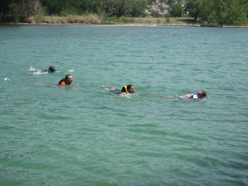
Leg 4 - "Splish, Splash, I was taking a bath..." - SwimNext on the agenda was a short swim leg. At previous incarnations of this race we would typically immediately set off to do the swim leg and save most of our usual transitioning stuff for afterwards. But not today! This time we actually took a break, sat down and got some real food and drink inside of us first, as we knew we had to refuel if we were going to have a chance of surviving the brutal heat. And at least this way we'd get to use our own life jackets instead of the camp provided ones, for once. The swim leg started with us flying down the huge water slide that dumps you into the lake. Fun, fun, fun! We swam north from there to the buoy where CP 16 was posted, then back south to a smaller, floating, inflatable slide.
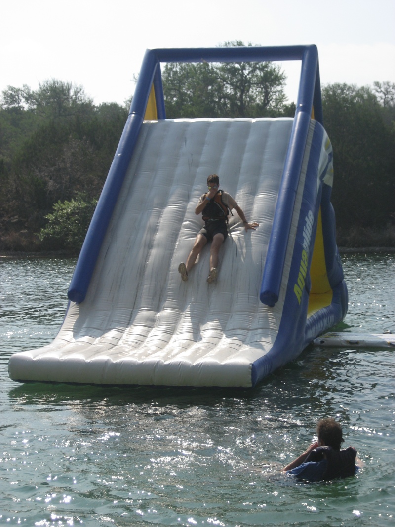
The inflatable iceberg from previous years was apparently gone now. Well, the inflatable slide was a lot easier to climb than the iceberg, so we weren't complaining. We punched CP 17 at the top of the slide. We could have slid down the slide at that point, but the final CP was in the water behind the slide, and we didn't feel like making the swim longer than was necessary, so we instead climbed back down the steps and headed off the back. Since we'd done the floating inflatable slide "the lame way", instead here's a picture of team Run Amok going down it "the right way":
After the slide we swam to get CP 18 at the southern buoy, and then headed back in. That was a nice, cool, refreshing leg to help us recover from the heat!
Leg 5 - "Around the World" - BikeThis bike would be mostly on old jeep roads that went up and down over the camp property. We would have to leave our bikes briefly to trek to some points on foot, but all the treks would be quite short. We assessed everyone's injuries and everyone decided they were still good to keep moving, so we were ready to go. Also, by now Ramsey had managed to repair Dave's bike seat using the clamp from Shauna's bike seat, so our damaged gear was managing to limp along about as good as our injured bodies. (Thanks, Ramsey!) No other teams had returned from the long trek yet, which on one hand was good news for us because it meant we'd built up a bit of a lead. On the other hand we hoped that none of the teams would be suffering too severely from the long trek in the atypical heat. The first checkpoint was a familiar one... if you've ever raced at Camp Eagle, you'll certainly remember the huge hill that leads up to the windmill, at the highest point on the property. We didn't do much biking on the uphill, instead we were all pushing our bikes and walking pretty much as soon as things got steep. We found CP 19 at the windmill, and since the windmill tank was full of water we decided to take another dip. We tend to jump in the water every chance we get when it's this hot! We biked along the plateau, then down a steep rocky hill, riding our brakes. Dave led us to the draw where we dropped our bikes, and we ran up the draw 100 meters to get CP 22. No problem. Then it was time to push our bikes up another hill, and ride along another plateau. The next draw was a little trickier to find, as there were several similar draws in the area, but we worked together and figured it out and found CP 20 on our first try. Yeehaw. Soon after this point we left the roads that were preplotted on the topo map to follow a road that the race directors had hand-drawn on the map. The hand-drawn road was more of an approximation than an actual GPS track, but we figured out the discrepancies as we rode. We descended into a large valley, looking for the proper side draw. This area can be confusing, as we know from experience since I messed up the navigation (big-time) in this same valley during a previous Camp Eagle race. The good news was, making that mistake in the past meant that I now knew what to look for to keep us on track, so we were able to avoid any problems this time around, and we went directly to CP 21. Perfect! We continued on the jeep road back to the main road, and then we returned to TA.
Leg 6 - "Row, Row, Row Your Boat" - PaddleTime for the paddle leg. We plotted the two points, and I was confident enough about where they'd be that I decided we didn't even need to bother taking the map with us for this. It's a pretty small lake, after all. We grabbed our paddles and life jackets, and headed down to the boat launch. Everyone had to use to plastic camp boats, but they're still much better than Sevylors! We paddled to the mid-point dam, and muscled the boats up and over the dam. Then we paddled north past the swim area and the slides. At the split in the lake we found CP 23 hanging from a bush, and then we turned back around. Back past the swim area, and back down over the mid-point dam. We paddled south to the big dam, trying to figure out which areas of the lake weren't too shallow to paddle on. As I got out to punch CP 24, my legs sunk down about two feet into the mud under the water... yuck. We paddled the boats back to the original launch site. Then I wanted to jump in the water to clean the mud off my legs, and fortunately everyone else wanted to jump in the water to cool off again anyways, so that worked out well.
Leg 7 - "Trails" - BikeFor the next leg we would have to bike to find five points along the bike trails. Unlike in some previous years, they didn't have a rule that stated we must stay on the trails, so we were allowed to take shortcuts if we wanted. Also new was the handy map they gave us that showed all the bike trails, with the points already preplotted on it. As we started out Jason realized his tire had gone flat. He pumped it up a bit and decided that it was a slow leak, so we figured we'd see if we could complete the leg without putting in a new tube. Of course, we took along a new tube just in case we guessed wrong about that! During these races I tend to be the one who does most of the nav while trekking, and Dave tends to be the one who does most of the nav while biking. But Dave said he was starting to feel a bit weak from the heat, and asked if I'd mind doing the nav for this bike section, too. Sure thing, I said, since I was the only person on the team not limping at this point (which is quite the reverse of normal!). We headed out to "Boot" trail, which didn't start exactly where it was marked on the map. Then as we started pushing our bikes through the woods to cut off some trail switchbacks, we realized the map wasn't quite correct again, as it didn't show all the switchbacks. OK, we'd better be a little careful with our shortcuts, then, since this map wasn't all that precise. But we still managed to make it to the intersection of "Boot" and "Moon" without getting lost, to find CP 25. We decided to play it safe for the next point, and stayed on the trails to CP 26. It was at the old Mine Shaft, where they've run special tests in the past. But this time, there was no test, just a checkpoint to punch at the top of the ladder. We got it, and Jason pumped up his leaky tire a bit again, then we continued down "Boot". We got to "Wagon" and I decided we'd try to cut off another trail switchback. I thought our shortcut was successful, but then the trail dumped us out onto the road by the screen shelters much earlier than I expected. Hmmm... maybe our shortcut had brought us onto another trail that wasn't on the map. We made our way along the shelters, trying to figure out if the "Wagon" trail started up again here, then finally decided the best thing to do was just ride down the road to "Mi Casa", as we knew what that structure looked like, and the checkpoint was plotted as being directly behind it. We didn't find the point in the immediate area around "Mi Casa", so we guessed that the "Wagon" trail must be higher up on the hillside above it. We trekked up, and sure enough, there was CP 27. Ok, we probably didn't take the most efficient route to get here, but we made it, so... hooray. We biked west until the trail ended at the jeep road. From here we could ride the "Armadillo" trail down, but that was a long way out and back, so we decided instead to shortcut again and bushwhack down the hillside with our bikes. We passed the new "Armadillo Spur", and got back on the main "Armadillo" trail at the bottom of the ravine. We crossed one creek bed, and I started looking for the point too early, but then Dave pointed out that the trail crossed a second creek bed just a little ways further on, and so that got us back on track. A brief out and back to the Oak Grove campsite earned us CP 28. The slow leak in Jason's tire was getting worse, so we went ahead and changed out his tube at this point. From here there was nothing else to do but ride the "Armadillo" trail out. Part of this trail has some rocky drops that I had to walk, but it wasn't too bad. We made it out and biked across the hanging wooden bridge over the river. CP 29 was under the bridge, and after that we headed on back to TA.
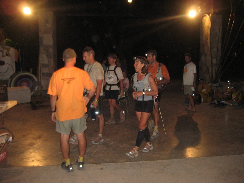
Leg 8 - "Fi-nally" - TrekThe last leg would be a trek around the camp's land. There were seven points, but at least they were relatively close together. Of course, there would be plenty of hills and valleys to climb up and down along the way. We'd built up enough of a lead on the rest of the teams at this point that we knew that we didn't have to go fast to win, we just had to be able to keep going. Of course, with Jason's ankle and Dave feeling sluggish from the heat, being able to keep going wasn't necessarily a sure thing. But it was nice to know we wouldn't have to bother running at all on this final leg. We started up the jeep road towards the windmill, then at the first ridge we bushwhacked our way down. We were looking for Porcupine Cave on the other side of the creek, which I knew from past races was a pretty small, easy-to-miss cave. When we got to the creek bed, I started looking at the other side to see if I could guess where the cave was, when someone on the team pointed out that they could see a piece of flagging hanging a couple dozen meters to our left, and should we check it out? Well yes, we should, as it turned out that they'd actually flagged the short entrance path to the cave this year. Well that makes it a bit easier to find! We made it to the cave, and Jason volunteered to climb in and get CP 30 so I could work on figuring out the next point. In retrospect it was silly of us to let Jason go in there with his hurt ankle... not one of our better decisions. But he managed to climb in and out without incident, fortunately. We debated whether to approach the next point from above or below, and I decided it would be less confusing from above. We climbed up to the plateau and followed the fenceline to where I figured would be a good attack point, then dropped right into the draw that contained CP 31. Nice. The next checkpoint had a similar story... travel along the fenceline a little farther, then drop off again into a different draw for CP 32. Done and done. Next we hit the windmill again, which wasn't a checkpoint for us on this leg, but it was on our way. And since it was on our way, we took the opportunity to get wet in the windmill pool once again. We traveled northwest along the jeep road for a bit, then headed off it to the south over the connecting peninsula. There were several draws in this area, so I tried to make sure we went into the right one, and... Yes... there was CP 36. Back up and over the plateau and down the big draw on the other side. We had to climb quite a ways down into this draw, but at least it was fairly open, underbrush-wise. We found CP 35 at the big draw intersection, and then climbed up out the other side to catch the road back up the hill and out. I towed Dave up the hill since he was still a bit wiped out from our earlier efforts in the heat, and by my count that means I only need to tow him another 99 times before we'll be even for all the bike tows he's given me over the years. An all-female team on an earlier leg passed by us on their bikes as we trudged along the road on foot.... way to go, ladies! We made it back to the windmill for the final time. By now the sun had set, so it was time to break out the headlights. Unfortunately, the last two checkpoints looked like they might be a little tricky, and we would have to rely on some more hand-drawn roads of dubious precision to get there. Well, we hadn't made any significant nav errors yet this race, so maybe our luck would hold. We went east along the main jeep road, then found the hand-drawn trail heading off to the north. We took it, hoping the next intersection on the map would be somewhat accurately placed. We actually wound up leaving the trail slightly before the intersection to find the point, but it worked out just fine, as we hit CP 33 dead on. Whew, only one more to go! Back onto the trail, which basically followed how it was drawn on the map, but not well enough to count on it for determining exactly where we were. Fortunately, we also had contours... I knew we'd want to start looking for the checkpoint when we hit a low "saddle" point along the ridge. We made it to the saddle, and went down the hillside, looking for the draw. We shined our lights around, but only saw more hillside sloping down into the darkness, and no signs of a draw. Plus, the direction of the slope didn't seem quite right to me. Hmmm. We went back to the trail and went a little further along the saddle, then tried attacking the point again. Once again, all we saw was hillside, and no draws. Well, I knew that since we didn't have a precise attack point from up above, we'd probably be better off approaching this one from a different direction, so we kept going down the hillside, past the point. I figured we'd eventually hit the creek at the bottom and hopefully be able to figure out the correct tributary draw to climb up from there. But on our way down, before we hit the creek we actually spied a draw. Was it the correct draw? I couldn't be sure, but the contours seemed to match the map, so I decided it was worth turning around before the bottom and heading back up the draw to check it out. And sure enough, there was CP 34, right where the draw petered out and became nothing but hillside. Alright, that was the last point, and even if it ruined our perfect nav record for the day, we were just happy to find it! We took the trail to the large camp cross, and from there we had to find our way back down to the camp again. We've had to find our way back from the cross point several times in years past at this race, and we still haven't found the best was to do it. We always just bushwhack generally southeast and down from here, never doing it the same way twice. But no matter how you go you'll always eventually hit the road, so at least there's no worry about getting lost. We made our way down to the main road, and then trekked back to the finish line to claim first place. Hooray! Way to hang in there until the end, everyone, despite all of the challenges of the day!
Post Race MusingsOf the 31 starting teams, the only other one that managed to clear all the checkpoints before the 18 hour cutoff was the team of Chris and Gabe. The low finishing rate was certainly due to the record high temperatures... everyone suffered quite a bit in the heat on the long trek of leg 3, unfortunately. Some teams had to drop out after that leg, but most persevered, and recovered, and continued on to complete the race in some fashion or another, even if they had to skip some checkpoints along the way. After the race Jason's ankle was really swollen and bruised (imagine that), so he and Shauna left on Sunday morning to get him to a hospital. He's generally recovering fine and getting back to normal, though the staff at the hospital couldn't understand why he would keep on racing for so long on his injured leg.
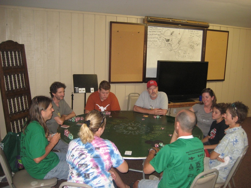
Do they perhaps have a point? I mean, why do so many racers keep pushing on towards the finish line, despite injuries and sickness, and suffering their way through all manner of discomforts? And of course it wasn't just us that faced difficulties at this event... there were many tales of perseverance against the odds from almost all the teams at this race, due in no small part to the oppressive heat. What keeps us pushing on? Why do so many ordinary people fight so hard to refuse to quit at these events? It's obviously not for the money, as most adventure races don't even offer any kind of cash prize to the winners. And it's certainly not for the fame, as adventure racing is so obscure that you first have to explain how the whole sport works if you want to talk to any outsider about it. Heck, it's not even about placing well at the event, as back-of-the-pack teams often keep pushing forward just as hard as the teams in the lead, if not harder. Why? I don't have a definitive answer to this question... even after a dozen years of adventure racing I really don't know exactly what drives us forward with such conviction. All I know is that I'm proud to be part of a sport that attracts so many stubbornly persistent racers. And I know that I'm incredibly lucky that I've had the chance to do so many races with teammates that really, really, REALLY hate to quit. Thank you, thank you, Thank You, awesome teammates! You're the reason that this sport is worth doing! Oh, and one other reason this sport is worth doing is for the post-race poker game!
|