Too Cool No Sweat 2009 Race Report
August 22, 2009Lake Travis, Texas
by Kipley Fiebig
|
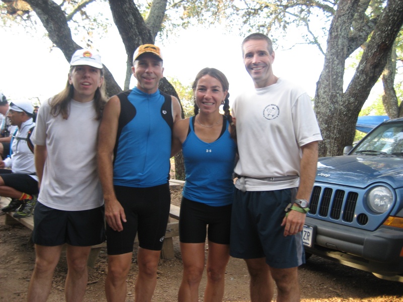
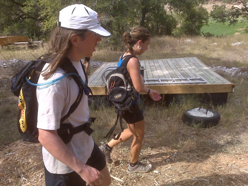
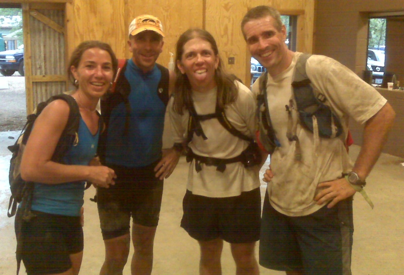
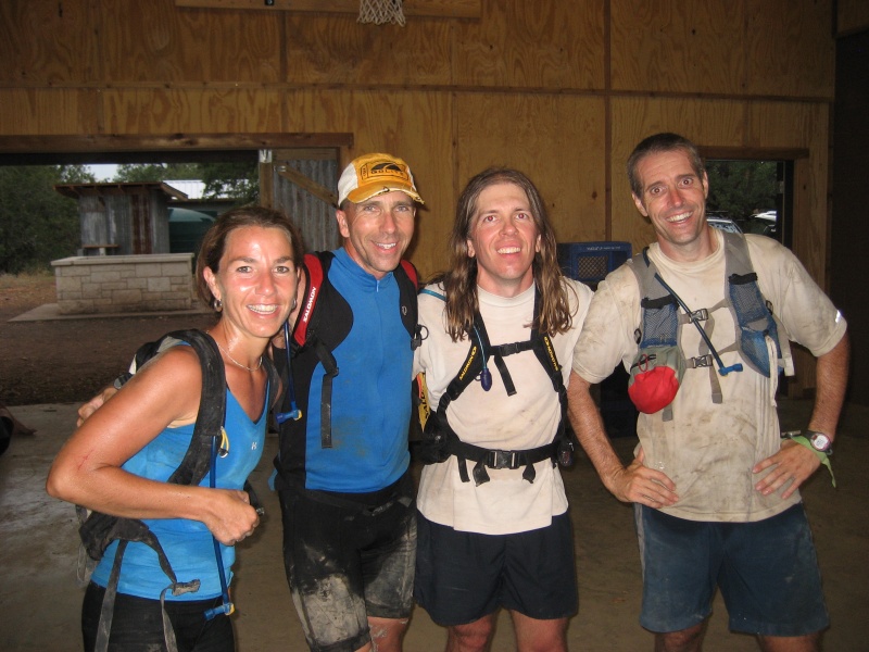
Leading up to this event, we fell victim to a fairly common problem afflicting adventure racing teams: One of our teammates was injured, so we had to find a last-minute replacement. Fortunately, Julie Standing was able to convince Doug Cousineau to join us just a couple of days before the race start. Dave Bogle and I (Kipley Fiebig) rounded out the fearsome foursome, and our wounded comrade Jason Mittman decided that if he couldn't race, he'd at least become our support crew so he could cheer us on (and yell at us to go faster).
Too Cool Racing was putting on this 24 hour race, ironically titled "No Sweat". The main transition area and start/finish line was at the Sunshine Camp on the north side of Lake Travis. Well, usually it's a lake... but with the drought we've been experiencing, the water level was much lower than normal. In many places the lake would be less than a third as wide as it was normally... and of course our maps displayed the lake at its normal, much higher level!
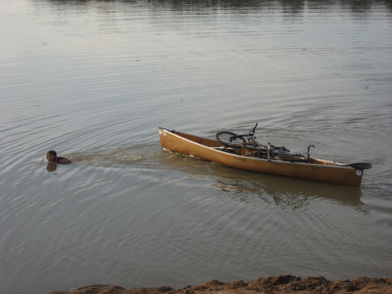
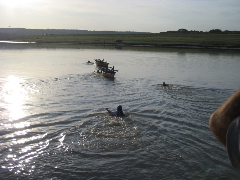
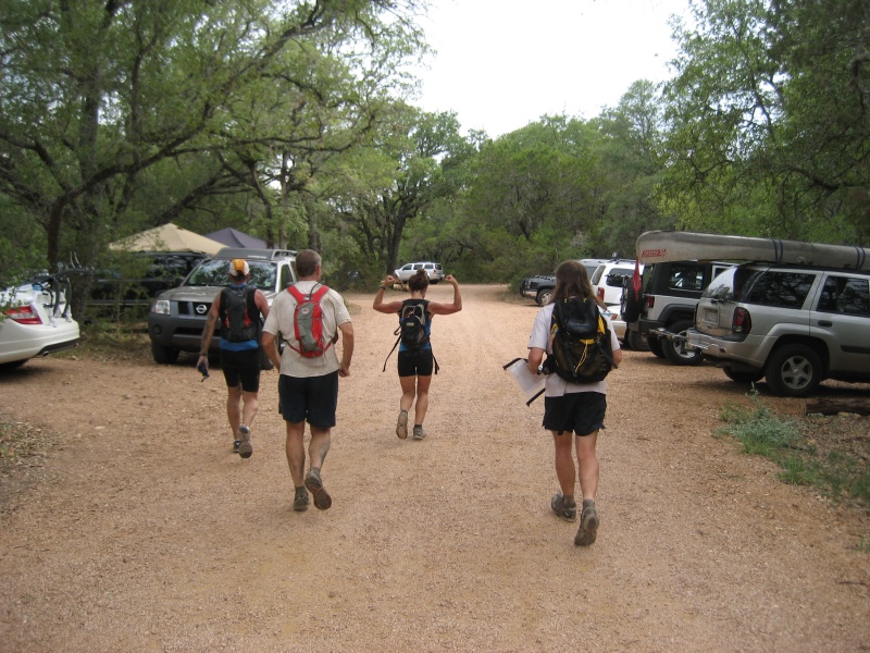
We setup our gear as the sun was coming up. There were no real surprises at the 7:30am pre-race meeting, so we felt like we had our stuff organized as well as could be expected by the 8am start. The instructions for the first leg were revealed... we had to put our bikes in our boats, and swim with the boats across Lake Travis to the other side. They also told us to be prepared to perform a variety of additional activities on the other side before returning, which threw a slight crimp in our plans because we had packed super-light on the assumption that the first leg would be a typical short starter leg. So Jason quickly filled up our packs with more food and liquid, and we scrambled down the long steep shoreline to our boats with our bikes. Since our boats were canoes instead of kayaks, they had plenty of interior space for the bikes. It was no problem fitting in two bikes per boat; we didn't even have to take any of the wheels off. We strapped fins onto our feet, as the swim was long enough to make them worth it. Then we launched the boats, being careful not to dump our bikes into the lake, and started swimming and towing the boats across.
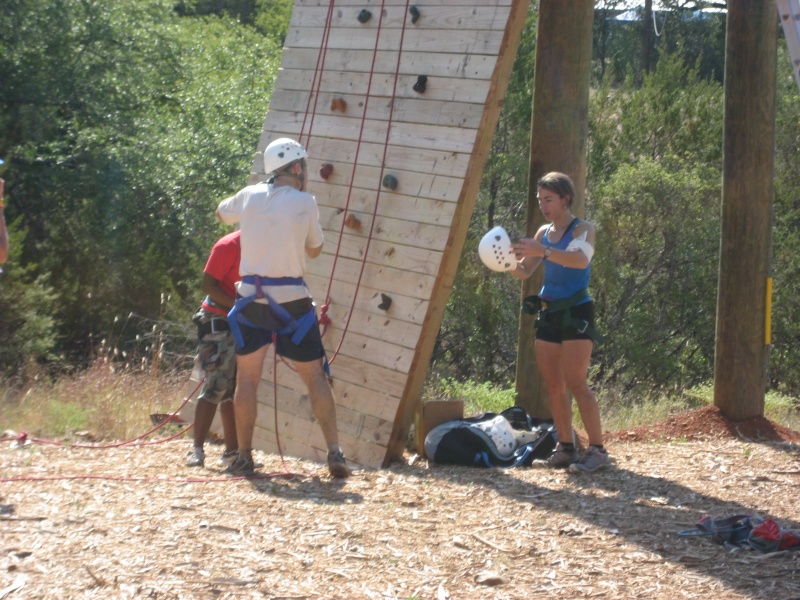
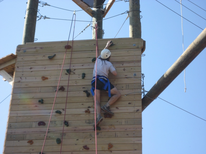
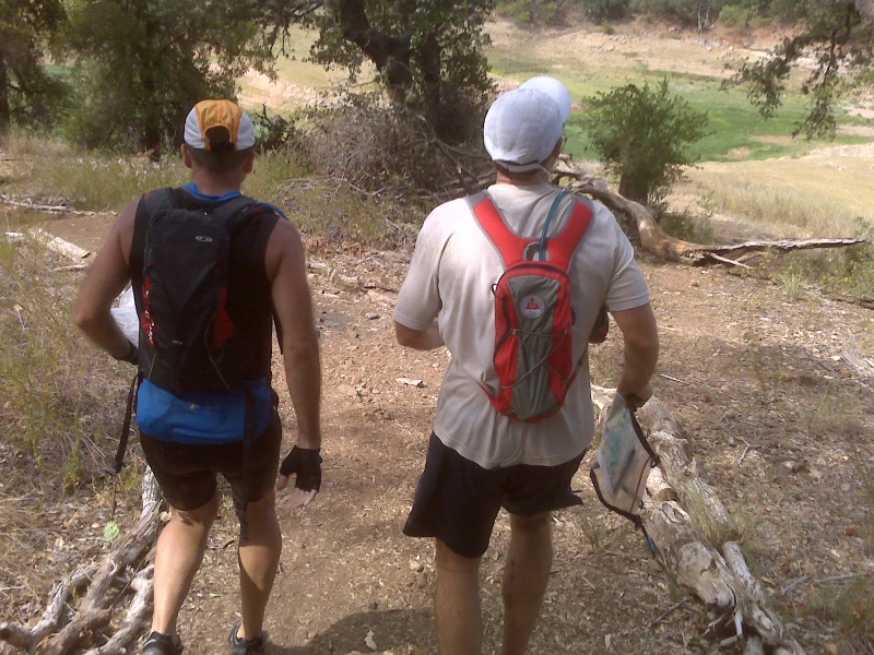
We got to the opposite shore quickly enough... the rest of the teams were still a couple minutes behind us. We pushed our bikes up the hill to the canopy where volunteer Sheila Reiter was manning checkpoint 1, and she handed us our next sheet of instructions. Biking... no real surprise there. We were on the edge of Muleshoe Park, which features a seven-mile singletrack trail loop. To get there, we first had to ride our bikes up the fenceline until we hit the trail. Once on the trail, Dave cleverly noticed that that we could cut off significant sections of the meandering trail by taking more direct routes through the woods. So we did, pushing our bikes through the trees where it made sense to do so. We collected CPs 2, 3, and 4. Julie took a nasty fall at one point, causing her bicep to swell up in a rather alarming fashion. We were all worried that it was a serious injury, but Julie said it wasn't really all that painful, so we cautiously continued on. Team iMoat zoomed by us on the way to CP 5, but since they were racing as a two person male team for this event we weren't all that concerned with how we placed compared to them. We hit CP 5 and stopped for a quick discussion on the quickest method to get back to the boats, and decided to turn around and head backwards on the trails a bit to where it hit a road, as that would take us out much more directly than following the trail. On the way back we encountered Team Werewolves biking along the trail to CP 5, and they were a four person coed team and so we were worried about staying ahead of them! Out of the trail system, and a short jaunt on dirt roads took us back to Sheila again for another sheet of instructions. Team iMoat had beaten us back and was just getting ready to take off again. It was time for us to drop our bikes and trek around Muleshoe on foot for a bit. We asked Sheila for any med stuff she could lend us for Julie's swollen arm, and she loaned us an ice pack for the leg. Thanks, Sheila! We did an impromptu wrap of the ice pack around Julie's arm, which was a bit awkward but better than nothing, and we were off. We could do these points in any order, and we decided that we liked the clockwise approach. We ran along an old dirt road along the lake shore to the first point. If the water in the lake had been at a higher level, the road, the checkpoint, and Sheila's canopy would have all been underwater, but not today. We spotted the point and Doug ran to tag it, while I worked on our route to the next one. We headed generally north and I thought about our route. One option was to keep following the lake shore around to the huge inlet where the CP was located, which was what I originally planned to do. But as we hit the main roads of the park, I changed my mind and decided to just stick to the road through the center of Muleshoe, and then take the side road to the camping area close to the CP. This route was slightly longer, but much easier from both a navigation perspective and a traveling perspective. It would be easier to keep track of exactly where we were on the huge inlet (with many potentially confusing incoming side reentrants) and it would be easier to run on the roads instead of doing a lot of trekking on the rocky, angled slopes of the lake shore. It was starting to get hot already, so we took it easy and walked a lot of the uphills. No sense in pushing too hard when we knew we'd be racing in 100 degree temperatures for most of the day. We headed down the side road to the camp area and crossed the inlet to where I thought the CP should be. It was slightly higher up that I expected, hidden in the tree line, but we'd approached it pretty much dead on, so I was happy with that. The map showed two different roads we could take on our way to the next checkpoint, and we decided to stick with the one we knew, and so it was back up the same side road we came in on. We then took the main road up to the start of the biking loop, and took a general bearing from there to the point. We paid attention to the terrain... we knew we'd go over a flat area for a bit, then down to cross a drainage, then up again to a hilltop where the point would be. It all unfolded as we planned, and we walked right to it. We tried to punch it quietly, as we heard other teams in the area. There teams were almost certainly doing the checkpoints in the other direction, and were hitting this hilltop as their first trek point, while we were now done, and heading back to the boats again. We followed the bike trail north for a bit, then it was time to abandon it and bushwhack to fenceline. The trees turned out to be annoying to get through on this little section, so we were glad we weren't pushing our bikes along with us at this point. We hit the fenceline and ran down to the lake again, exchanging high fives with all the teams that were starting out on the trek leg who choose to do it in the counter-clockwise direction. We were instructed to just leave our bikes where they were on the shore, and paddle the boats back across the lake. We docked the boats and noticed that we had managed to pass iMoat on the trekking section. We climbed the hill back to our main transition area and got the instructions for the next leg. So much for the theory that the first leg is always a short one... this was our first time back to our refueling area. You just never know what's going to happen in an adventure race, that's why we love 'em. We called the medic over to look at Julie's still-swollen arm. It was decided that if it were something scary-serious, that it would hurt a lot more than it did. So the medic wrapped it up better than we'd had it, and we set off on the next leg. Which was a tall climbing wall located nearby, within the camp itself. We jogged over there and put on harnesses, as each of us would have to make it up the wall. We told Julie that if her arm was giving her any sort of trouble she should just skip it, as it was only a fifteen minute penalty per person who skipped, but Julie scrambled right up the wall without any problems. That certainly increased our confidence that her injury wouldn't slow her down much. Which isn't surprising, as nothing really slows Julie down much.
Team iMoat appeared and started climbing the wall as we were finishing. We hustled back to TA and got the next leg. It was time to head down for the boats again, and do the short paddle across the lake back to our bikes for a longer road biking section.
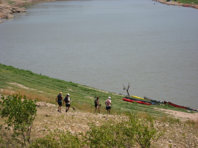
And so, we were off, grabbing our bikes at Muleshoe and saying hi to Sheila once again as we headed out. On the paved roads, we set up a paceline and cruised along. Team iMoat got ahead of us, which was expected as they're excellent bikers. But what was surprising is that we could continually see them up ahead, and they weren't really putting all that much time on us. Sweet. We came to an intersection that was basically the decision point for what order you'd visit the three bike points. Dave was navigating us on the bikes, and he decided to do the opposite of what iMoat did, just to make it interesting. So we went counter-clockwise, and headed down to a park where the clue for the CP was "picnic". Turns out that there were many picnic tables in the general area, and we biked by all of them without spotting the CP. Hmmm. We looked at the map and debated where it should be. The instructions indicated that this CP would be made out of PVC pipe instead of the usual bright orange flag, which would make it harder to spot. So we all sort of split up and wandered around the area until I was lucky enough to spot it, hanging on the back side of a tree we'd rode by before. We regrouped and headed out of there, hoping that we wouldn't be the only ones who had trouble spotting that one. More paved roads, more hills. The next CP was in an oak grove just off a road intersection. We managed to ride by it just like the previous CP, but only wasted a minute before turning around and finding it, so at least our recoveries were getting faster. Two down, one to go. The final CP was actually at a convenience store, which is pretty unusual for an adventure race. The race directors were being friendly, giving us an obvious opportunity to step inside and buy some food or drinks. But we all agreed we didn't need anything other than what we already had in our packs, so we just wanted to find the CP. Team Werewolves had just arrived at the store as well (though they'd gone clockwise, so this was their first CP on this section), and all eight of us managed to ride right past the CP and had to backtrack before seeing it. We went zero-for-three on this leg in spotting these CPs on the first try! I guess we need to get our eyes checked! We cruised on the paved roads back, and even had road signs for once that pointed us the way to Muleshoe in case we were confused. Only a mile from the park Doug's tire, which had had a slow air leak for a while, finally became too much of a problem to ignore, so we stopped to quickly change his tube. Back on track again, when suddenly Dave's tire started making hissing sounds. What's with all these flat tires from riding on paved roads? Aren't we used to dealing with riding on rocky trails covered with cactus? We were so close that Dave figured he could make it back to the boats without changing his tire. He was mostly right... though the flat tire certainly didn't help him on the steep downhill along the fenceline, as his bike slid out from under him and he took a nasty fall. But, apparently no real harm done, as he got up again and we limped our trashed bikes back to the boats. We'd been instructed to bring our bikes back on the return paddle this time, so we figured there would be no more biking on the south side of the lake, at least. We had had to swim the bikes in the boats over the first time, now we could paddle them back if we wanted. We weren't sure how well we'd fit into the boats with the bikes, but we gave it a try and it worked well enough. We paddled slowly and cautiously, as we certainly didn't want to dump everything into the lake, but the paddle was short so it was fine. Other side: boats out, bikes out, back to the transition area. We gave our bikes to Jason along with a lot of instructions on how he could fix them up while we were off the on the next leg. Because we'd hate for Jason to be bored while we were gone! We were due for our the first "real" paddle... so far the paddles just crossing the lake had taken hardly any time at all. But now we had to take our boats a few miles downstream, to dock at Gloster Park for some navigation on foot.
The paddle went well. Julie was able to paddle despite her bruised arm, which was nice. We could see iMoat's boat off in the distance until they turned around a bend in the river. The sun was blazing down by now, but at least we had Camelbacks that were full of cool liquids to drink. We were to leave our boats at CP 13, which was in an inlet. Our maps showed it as being in the middle of the lake, which was typical for the shoreline points for this race, due to the low water level. But it meant that finding the correct inlet could be tricky, as we wouldn't have much feedback from the map as to how the new, much lower level of the lake should look. But we figured that the point would probably be obvious, and if nothing else, we would likely spot iMoat's boat and that would let us know we had made it to the correct inlet. We were wrong! We passed one inlet that Dave thought might be the proper place for the CP, and then came across iMoat's boat at the next inlet. We docked as well, and got out to look around... no CP. Team iMoat had already disappeared on the trek, so we had no idea if they'd found CP 13 yet or not. Time to look around a bit. We scurried over land from inlet to inlet, looking for the CP in vain. We were seriously beginning to suspect it wasn't here. Technically, we were supposed to visit CP 13 before we hit the three trekking points, but since we were now fairly certain that CP 13 was gone, we decided it was time to trek. However, now we weren't exactly sure where we were. Without CP 13 to help us pinpoint our location, all we knew was that we were somewhere on the shore by Gloster. But where? There were many inlets and roads heading down... we just needed to figure out definitively which was which. I had us head up an inlet that I figured might lead us to one of the trekking points. It did not... instead it dumped us out on a road. Then I got confused about which road we were on, as there were many crisscrossing roads in the area, and we'd been wandering about without knowing exactly where we were on the map for over a half an hour now. We followed the road around and back down to near our starting point. We sat for a bit and I talked to Dave and we figured out our possible locations. While we couldn't know for sure yet, we decided it had to be one of two spots, and it should become apparent if we walked back up the road and followed the map closely. So we did. I became more and more confident that I was determining where we were, but wasn't going to say that for sure until we found a checkpoint. Along the roads, the intersections and directions matched up with what I was hoping to see, so it was time to veer off the road and down into a drainage. And, thankfully enough, there was the checkpoint. We compared the UTM numbers on CP punch to the ones on the clue sheet, so we could finally say for the first time in an hour that we were 100% confident about where we were! Time to start moving with purpose again. We headed back to the roads, then down into another draw for the next checkpoint. And finally we took an old road along a long fenceline that lead us to a creek, where the final CP for the leg was located. Time to head back to the main road, and jog back to the boats. We'd been wandering around in the blazing heat for far longer than we'd wanted to this leg. We discussed doing one last gasp effort to find the missing CP 13 before we headed for the boats, but as we exited Gloster we were able to look around at all the possible locations it could have been and say, "yep, we checked all those already". So, to the boats. As luck would have it, Team Werewolves had just landed their boats by ours, so we passed by them on our way out. They asked how the leg went for us, and we let them know we had problems without specifically telling them that CP 13 was missing. We would have liked to have been friendly and just let them know that we hadn't found the checkpoint, but they were the next coed team and we were still worried about them catching up to us. So we figured if we had wasted time looking for a missing CP, it would only be fair for them to have to go through the same process. We dunked ourselves in the water to cool ourselves off before getting back in the boats. It was definitely over 100 degrees by now. We paddled back, wishing that the clouds off in the distance would move in and give us some relief from the blazing sun. Back in TA again, we leared from race director Art that iMoat hadn't found CP 13 either, so it was pretty much confirmed that that point was missing. The next leg was more of the same... only paddling upstream this time, before beaching our boats and getting three points in another park. We had a rather long transition this time as we all needed to cool down a bit and eat and drink. Team iMoat had taken an even longer rest, though, so we were actually close behind them by the time we were ready to head out.
As we paddled upstream the lake became shallower. Soon we had to travel to the opposite side just to find some deeper water to paddle in. We reached the checkpoint where we had to leave our boats to start the trek. Team iMoat was there just ahead of us, having had difficulty getting their boats to shore through the deep mud. We went through the same obstacle, walking our boats through the mud while leaning on them to let the boats take some of our weight, so we wouldn't sink quite as deep with each step. Finally, our muddy boats and bodies were at the shore, and we punched the CP. There was actually another paddle point we were supposed to get that was even further upriver. But this race allowed you to skip any one checkpoint you choose with no penalty. Now that we'd seen the shallow water and mud that awaited us upstream, we were strongly considering skipping the upstream point. But we agreed that we'd get the three trekking checkpoints first, and make the final decision when we returned to the boats. For once, we decided to take a loop in the same direction as iMoat, and we ran after them across the field to tackle the first point in the clockwise direction. We left the field up a road that went up a steep hill, and the checkpoint would be found in a draw off the left side of the road. I pulled the trigger too soon and left the road early, and got us into the wrong draw, but we recovered fairly quickly, and learned that iMoat had made the same mistake. Farther up the hill, we found the correct draw and the checkpoint, and made our way back to the road. We hadn't seen iMoat punch the point, and they were on the road ahead of us. We continued up the hill, when iMoat suddenly went off the road to the right... which was the wrong direction. That was weird. I looked at the map to make sure I wasn't missing anything, and decided we were still on track, and so we continued on. We finished climbing the hill and jogged across the flat plateau to a fenceline. Then we followed the fenceline across to a drainage with the next checkpoint. No problemo, and there was a road by the point (that wasn't on the map) that roughly followed the fenceline back, so we took it on the return trip. We continued on this unmapped road down into a drainage system. We debated exactly where we should turn off the road and enter the drainages, but there was really no wrong answer as all the drainages were heading down to the same big creek, where the final CP would be. So we went down when the underbrush looked the friendliest, and to our surprise it turned out that there was a beautiful trail that followed the creek all the way down, and took us around all the obstacles in the way. What a luxury compared to what we have to fight through during normal bushwhacking in Texas! We found the final CP right where it should be, and followed the trail back out to the big field. Then we ran across the endless field back towards our boats. We were feeling pretty good at this point. Unless iMoat had been doing something really clever, it looked like we had passed them when they took their wrong turn on the trek. And the clouds had finally rolled in overhead, which made it feel cooler out there. The temperature had probably only dipped slightly, but being out of the blazing sun and having a cool breeze made a huge difference to our morale! Back at our boats, we confirmed it was the best case scenario for us: Team iMoat's boat was still there, so they hadn't finished trekking yet. And no other boats were there, so no other teams were hot on our heals. We made the final decision that it would take forever to slog an additional 1.5 miles through mud with our boats to get the other upstream checkpoint (#21), and so that was officially now our one freebie "skip point" of the race. Hopefully, there wouldn't be anything on the final leg that we wanted to skip even more! We started paddling downstream back towards the TA. A young guy drove his motorboat towards us, and asked us if the water got shallow up ahead. We warned him that it did indeed, and he should turn around unless his motor was really strong! We arrived back at the TA and took our boats out of the water for the last time. The final leg was a trek around the TA park to get four checkpoints. And none of them were all that far away. Yes! Our decision to skip checkpoint 21 had been a good one! We quickly refueled and headed out on the trek, for once in the lead without any other teams chasing immediately behind us.
The first point was easy, in a culvert under the main road. Dave volunteered to crawl in and get it. Up a big hill on the road, then along the top to a fenceline. The next CP was also easy, just follow the fence a bit to a drainage, and there it was. No problem. The third CP would be the tricky one. It was farther off the road, and it a bit of a maze of drainages. We followed the fenceline away from the road, using the contours to keep track of our exact location. So when we finally headed down a drainage, I was confident I knew exactly which one it was. We we came to a big drainage intersection, we encountered a team doing the shorter 12 hour version of the race. They apparently had to find this same checkpoint. The girl informed us that they'd been down this drainage all the way to the lake, and hadn't seen it, so they were stumped. Well, I was still pretty sure I knew where we were, but it was nice to be warned that it might be more difficult than we'd anticipated. We told the team we'd yell out if we found the checkpoint, as I thought it should be less than 200 meters away, just up another side reentrant. So we traveled down, carefully pacecounting, and sure enough, there was a small tributary coming in from the side. It would have been easy to miss if you weren't looking carefully. Dave went up it and confirmed that the point was there, and we yelled back to the 12 hour team to let them know where it was. They were quite happy to hear it. Only one last point to go! We jogged back down the road, and were beginning to suspect we could finish our 24 hour race in under 12 hours, which was a fun goal to shoot for. The final point was not very far from the TA at all, just off a short side road and down in one last draw. Julie found it, and we were heading for home. Doug saw iMoat in the area, but they had just barely got this point as their first one for the leg, so they wouldn't be catching us today. And with that, we jogged in, finishing in first place overall out of 15 teams. It turns out a lot of teams had really suffered in the brutal heat. Most were able to eventually recover and keep going though, and some hung in there to make it to the finish after 23 hours of racing. Now that's perseverance! Thanks to my most excellent teammates Dave, Julie, and Doug for coming along for this most excellent adventure. And thanks to Jason for being an incredibly helpful support crew, keeping us stocked with food and fluids and basically taking care of our every need every time we saw him. Thanks to Art, Robyn, and all the volunteers for putting on a much too cool race! I daresay this was the most fun our team has had at a No Sweat race so far!
|