Too Cool "Big Chill" 2008 Race Report
January 26-27, 2008Bastrop/Smithville, Texas
by Marcy Beard
Photos by Bryan McKenney
|
Previously, on "Big Chill": Wind, rain, frigid temperatures. An angry lake, big waves. Frustration at Rocky Hill Ranch. "Never again!" Kip screams.
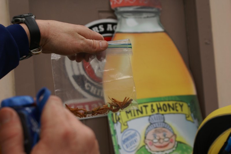
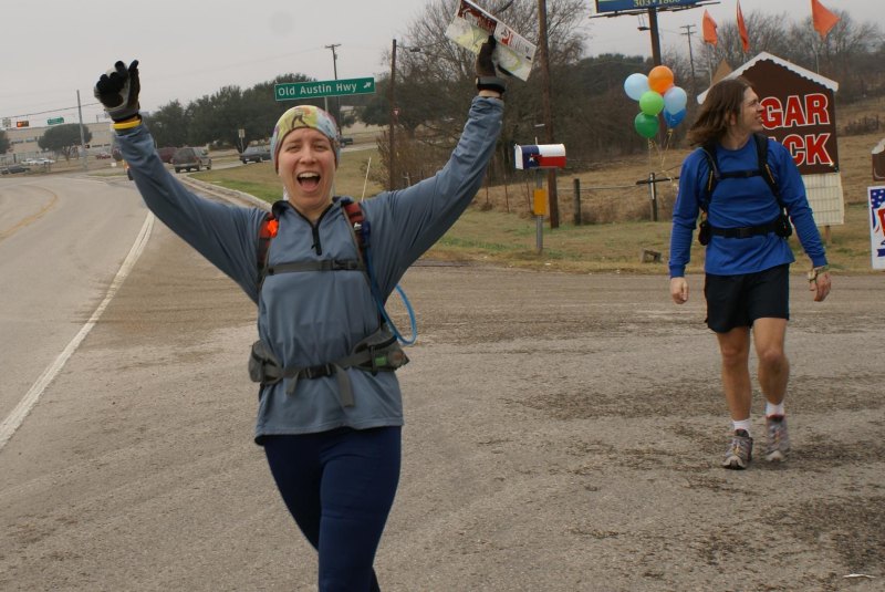
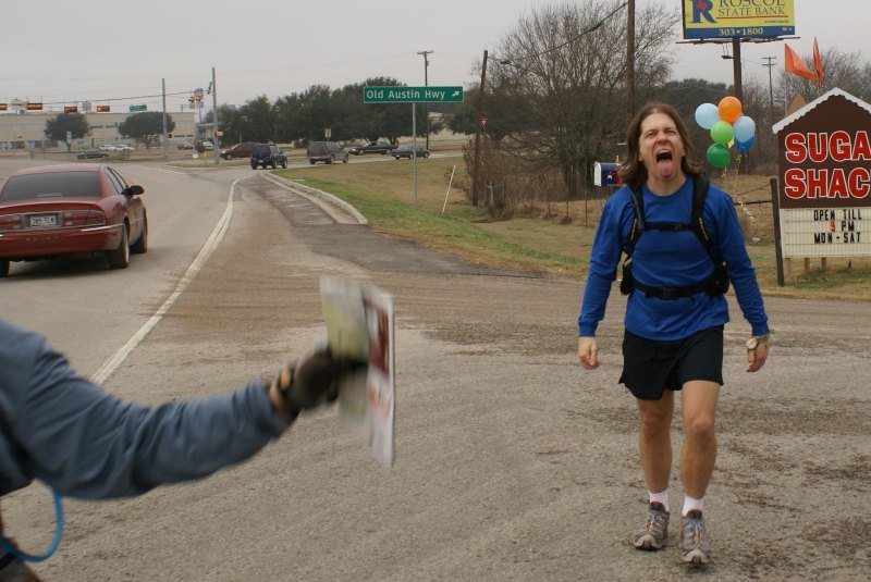
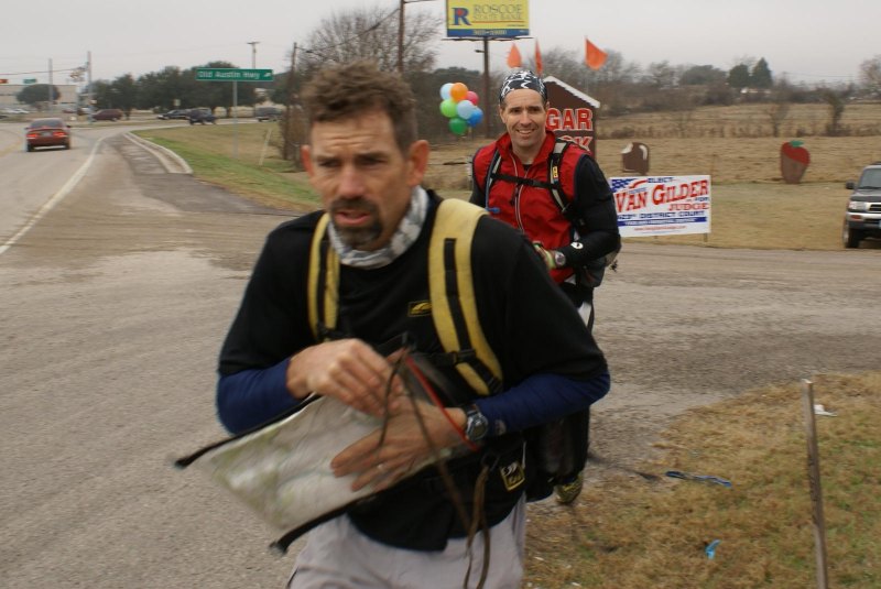
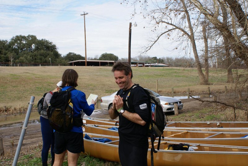
Tonight, in a new 2008 episode of "Big Chill": Sunshine. A beautiful river. Real navigation at Rocky Hill Ranch. And Kip has changed his mind! Stay tuned for all the adventure and excitement! The promise of a river paddle was enough to sway Kip into doing the Big Chill race again this year. Dave was rarin' to go, so when John and I decided we'd still be in Austin at the end of January, it was a done deal. Team V was on the trail again. The race started on school buses again this year, but sans blindfolds this time. When the buses turned north on 95 toward Elgin, chatter erupted among the racers, a debate on where we might be headed. Then it became clear that we were going to the high school where, someone guessed, the buses needed to be returned anyway, so why not? We piled out and were handed an envelope and a map of downtown Bastrop. Cool! I like city maps and urban racing. Upon hearing the word "Go!" we tore open the envelope and found out we were doing the "Amazing Bastrop Race". Fun! Our first clue involved finding a place in Historic Downtown Bastrop that might contain works by Poe, Hemingway, King, and another author I'm ashamed I can't remember. Maybe we need to go to the school library? Oh wait, we're not in Historic Downtown Bastrop yet. We started jogging in that direction while John tried to place us on the map. Kip had the awesome idea of trying to phone up some on-the-spot computer support to help us locate the library online. I tried a couple numbers but didn't get anyone to answer (the race directors must have warned everyone's family and friends that they weren't allowed to assist). Meanwhile, the rest of the team flagged down passing motorists and got directions to the library. We ran there and found our next clue. We had to unscramble two words to find street names: MAIN and AUSTIN. We headed in the direction of that intersection, first taking the long way around a construction zone. On the way over, I read the rest of the clue and realized that we were going to the museum - hey John, over there! Tom from Team Werewolves was the first to go inside the museum and find the next clue, and I followed him to find an envelope and a local Bastrop newspaper. We searched the paper for our clue, then Dave spotted a "Too Cool" logo and the words "KERR PARK". We pulled the ad out of the paper, ditched the rest of the paper in someone's trashcan, and ran east. A string of racers followed us a few blocks where we found a Detour: Either go to the courthouse, or buy one can of food to donate to the Food Bank. We heard MOAT nearby saying something about not having any money (the suggested gear list had included "a few bucks" which had us hoping for a mid-race hotdog opportunity). We took off toward a convenient store where John ran in to buy a can of beans. It sure would have been fun to be in that store for the next few minutes, as other racers were barreling in that direction. We learned that MOAT had bummed some change off a truck driver, just barely enough to buy their can and avoid a longer run to the courthouse. Back at the park we got our next clue. It had an old photo of a bank on Main Street. We ran back a few blocks, greeting teams as we went. As we passed the Wells Fargo we saw Team Chubby Bastardos - eating hotdogs that were being giving away at the bank! Too funny! We ran down the middle of Main Street, looking for the building. Dave asked a pedestrian where this bank used to be, and they immediately knew that it was now the Visitors Center. Team MOAT was hot on our heels as we got our next clue. Together we headed to route 150 going across the river, looking for something "sweet" on the other side where we would perform a final challenge to get our maps and coordinates for the next leg. When we saw the Sugar Shack, we guessed it was an eating challenge. They wanted us to designate one person to perform the task, so Kip volunteered. Through the store and to the back - where we learned that Kip would be eating bugs! Go Kip go! He sat next to Dave from Team MOAT, downed his bugs (he said they weren't alive, and they melted in his mouth...), and showed his empty mouth to a volunteer. Yay! That first section was a lot of fun.
|
|
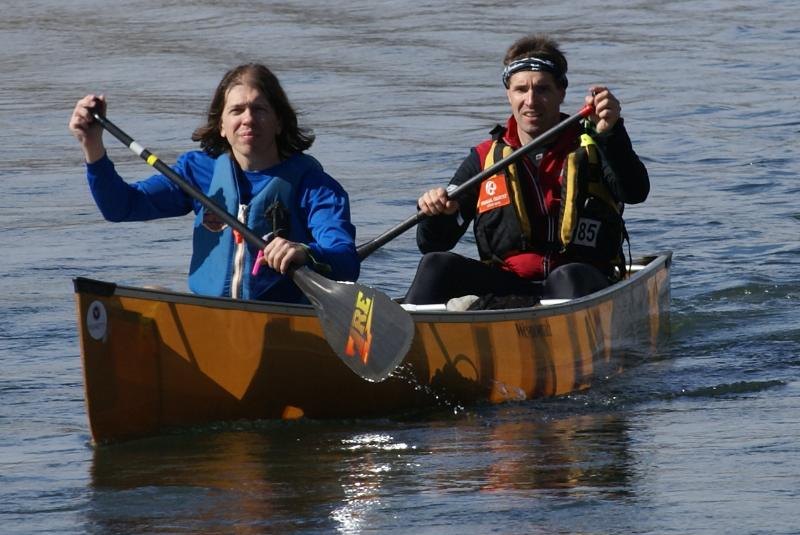
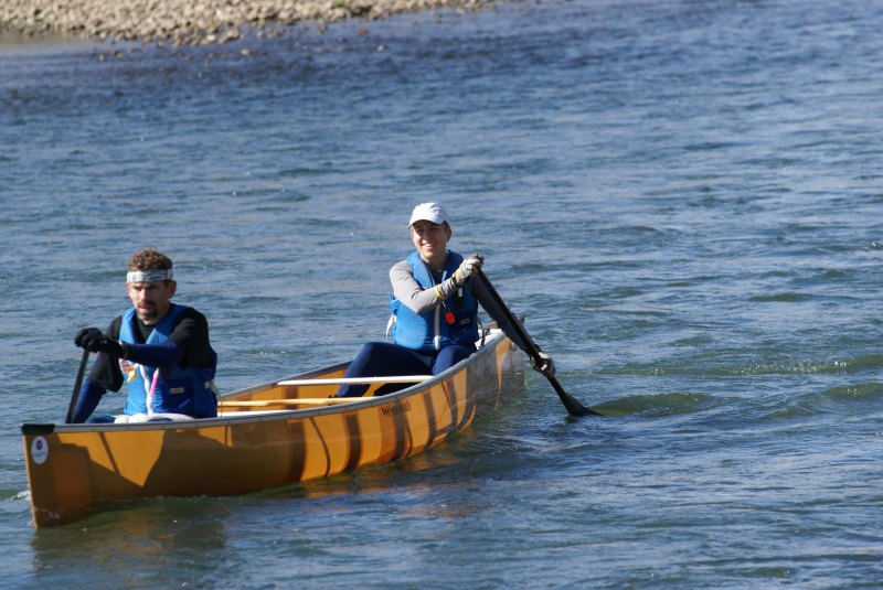
We plotted points for legs 1 (paddling) and 2 (biking), and then jogged back across the river. We made our way to the street next to highway 71 and on over to the railroad tracks. The tracks took us on a straight shot south toward the boats. They were decent tracks for running on, so we were happy enough with that route choice. MOAT wasn't far behind when we ditched the tracks for a parallel dirt road. We all hit River Road at about the same time, and we followed MOAT over to the boats. It was a gorgeous day for a river paddle. We weren't too hot or cold, there was hardly any wind, the water was high enough in most places so we could paddle over everything, and occasionally there were little rapids to figure out to keep things interesting. We saw a hawk catch a snake and carry it away! John and I did some amateur bird watching and tried to ID some killdeers, kingfishers, and what might have been plovers. Dave pointed us to CP2 on river left, so John got out to punch it. The next section was pretty long, and we figured MOAT was gaining a decent lead on us. Sure enough, they were leaving the CP3 boat drop as we got close. It was really nice to be able to stretch our legs for a few minutes while finding a checkpoint in a pecan orchard.
|
|
Kip put us on a good bearing as we crested the bank and started into the orchard. He started talking excitedly about how that bearing and the lines on the maps should all point us exactly toward... then I interrupted him with "I can see the checkpoint!" We were still maybe 500 meters away from it, which has to be some kind of a record for Too Cool checkpoint visibility.
|
|
We ran and punched it, then John mixed some SPIZ so we could get some kind of refueling going before taking off again. I got pretty hungry during parts of the paddle, but managed to suck down most of the quart of Gatorade we had in our boat. Several kilometers after CP3 we started seeing landmarks we recognized from previous USARA races and other workouts, then we were though Smithville and aiming for the end of the paddle.
|
|
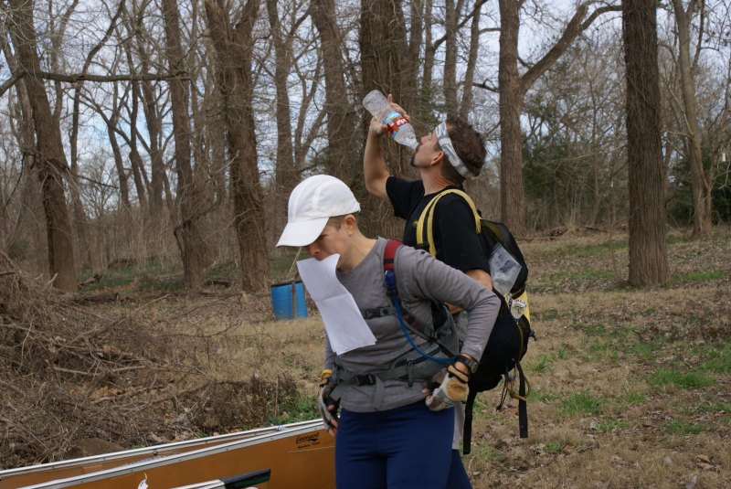
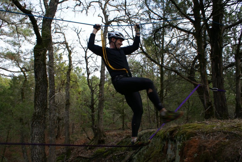
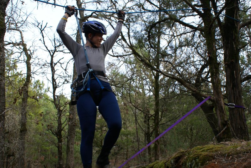
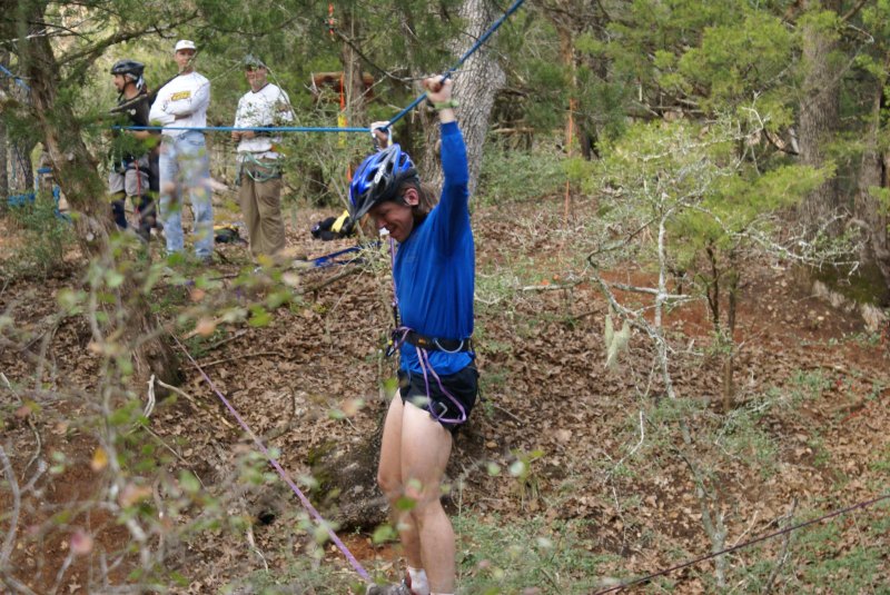
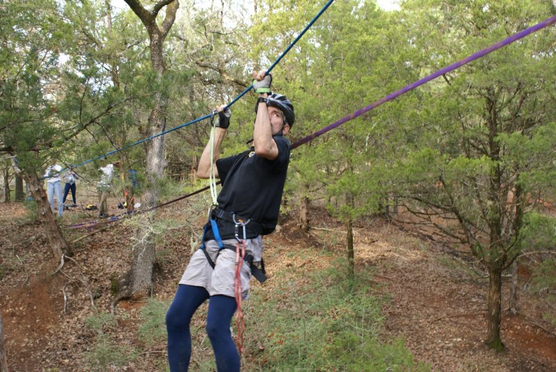
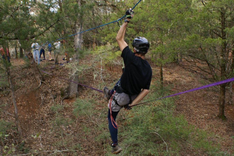
I recognized the park at the take-out, but couldn't recall exactly how we had previously gotten from there to Rocky Hill Ranch. A car was leaving one end of the park but we couldn't say for sure from the map that the road would get us out the right direction. My bad, for not scouting this when I figured this park would likely be the take-out. We ended up running alongside highway 71, then cutting over on 2-Mile Lane, while there was a more direct route up Ethel Drive, darn it. Along the way, we started looking at the maps for Rocky Hill. In previous races we had been told to ride certain trails and stay off certain roads, looking for points along the bike trails. This time we were given a separate GPS trail map overlaid on a topo map, plus the regular park map. The checkpoints were plotted on our race topo map. The question was how to effectively use all of this information. We decided to try transferring the CP's to the GPS trail map, so Kip and I worked on this as we walked up 2-Mile Lane. He used the UTM grid on the trail map, plus the topo lines, to place the points. We ended up with a pretty decent map, so we decided John would take the trail map and Dave would have the race topo map (with better topo lines). We jogged the rest of the way to Rocky Hill, got our bikes and ropes gear, and started up the trails. There had been a lot of rain the previous week, so we were wary about possible mud bogs. The trail was slippery in a couple places and rather muddy in a couple others, but for the most part we were really surprised at how good the conditions were. The first CP was just off the trail on a spur along the right fence line. Continuing on, we located the ropes set up across a ditch. Hi Brian and Sarah! With harnesses on, we took turns walking across a piece of webbing while hanging onto a rope above us (with a lanyard tied into the upper rope). I managed to keep my feet on the webbing, leaning into the upper rope for support. John managed to come off the webbing but used his strength and agility to regain his feet. Quite the feat, although mostly overlooked as the rest of us were scrambling to get our ropes gear off and get back to the bikes.
|
|
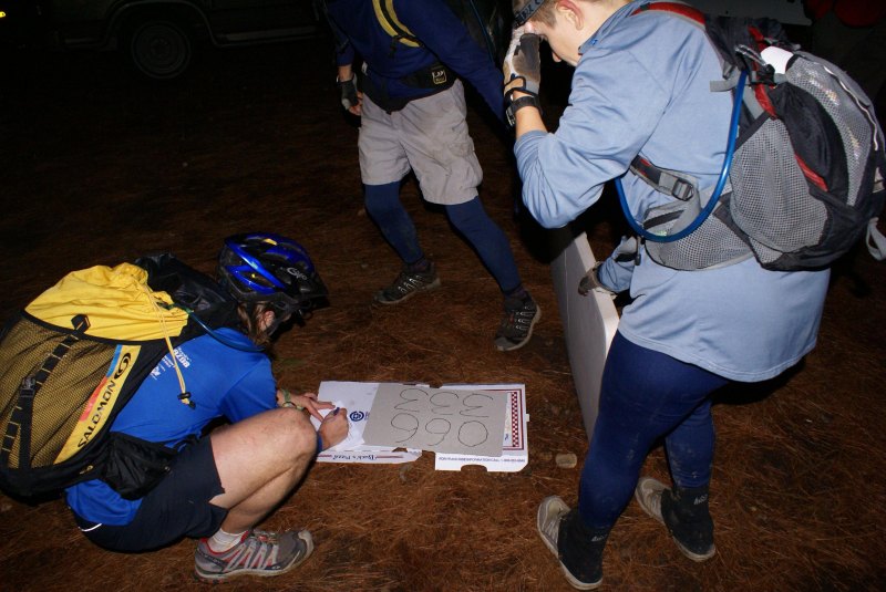
We took a CCW route for the remaining bike points at the ranch, following dirt roads and trails, watching contours and figuring out how to maximize our time on trails while still locating the points quickly. We went back and forth between checking John's trail map and asking Dave about the contours. Kip was especially excited that we were skipping trails in favor of riding dirt roads whenever we could. This was, by far, the most interesting and best laid-out navigational challenge we have done at Rocky Hill. CP9 was off the top of the trail map, which seemed odd. When we got to the northwest corner of the trail map, we found an old path that sort of followed the fence line, leading us to the checkpoint in a draw. Cool, we've never been up there. The only challenge was figuring out how to get from the west fence line over to Longhorn Loop. It didn't actually require a bikewhack, but we did a short one anyway. After punching our last ranch CP, darkness fell. We rode back to the front of Rocky Hill, collected the rest of our stuff, put on headlamps, and started down the road toward Buescher State Park. CP15 was located just off the road in the park. We passed a team of 2 guys who had skipped Rocky Hill Ranch and were heading back to Bastrop State Park. A couple kilometers up the road, we parked our bikes to head into the woods toward CP14. This looked like a rather tricky one. Kip did some awesome nav along the hilltop, and once we figured out exactly where we were (after a short backtrack), he took us confidently around, down, up, down, and up again, right to the checkpoint. We heard voices below us and saw bike lights, but had no idea until after the race that we were suddenly really close to Team MOAT. They spent some time finding CP14, getting back on their bikes and out of the area just before we did. We just figured it was another team that had skipped Rocky Hill or something. On the way back to the bikes we heard honking. Hmm, now what? We sped up a bit getting back to the road, glad to see our bikes were still there. A park ranger or someone like that came by a couple minutes later, glad to see that we were now with our bikes - she said she was about to call the Sheriff! The rest of the ride back was uneventful, except for a couple stops so John could air up his front tire. It had been leaking since we got onto the paved roads, but it held up long enough that we didn't use quite all of our CO2 cartridges. We took it easy on the uphills, hoping not to wear out anyone's legs just yet. After all, as we said a few times, we're not racing MOAT - they're the National Champions, for goodness sakes. Back at the TA for the first time in, let's see, 11 hours, we picked up our next clue and a jigsaw puzzle. Fun! MOAT was just leaving the TA when we arrived, huh, that's odd, oh well, we've got a puzzle to work on. The main challenge was figuring out how we would transport the completed puzzle back to the check-in table, then turn the puzzle over to get the coordinates written on the back. We ended up carrying it over on a table top to show Robyn, then using an empty pizza box as a support to turn the puzzle over.
|
|
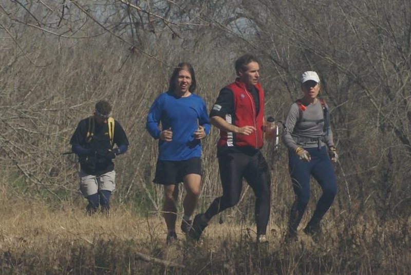
The next leg (#3 of 6, we now saw) was one CP, on foot. The clue was "jalopy", so if we had known that, we would have left without spending time on the puzzle or getting the coordinates! Luckily Art and Robyn know that we can be sneaky little buggers, so they didn't give us the jalopy info until our puzzle was done and back in the box. You see, there's only one jalopy in Bastrop State Park - it's an old car off the side of a trail, labeled as "Manmade Junk" on the orienteering map. We ran on park trails down and across to the road on the other side, then up to the jalopy trail. After finding the car and CP16, we reversed tracks and headed back to the TA. The next leg was a ride-and-tie, i.e. a 4-person team can use 2 bikes. CP17 was at the water tower (which we could have punched 3 times already if we had know it was there). Dave and I rode while Kip and John ran along the road. On the way back, we figured it made sense to try putting all 4 of us on the 2 bikes. John stood on the pedals of my bike and steered down the long hill, while I sat on the seat and hugged him. Kip and Dave managed something similar, although probably with less screaming and hugging. We saw Team MOAT heading up the hill on bikes - hi again! Through these middle legs we were about 30 minutes behind them. Not bad, since they are the National Champs and all : ) Back at the TA, we got our next set of CP's to plot. Looks like we would be going to the power line, as we had guessed. And also all the way out to the graveyard (spooky!) - wow, that seems like a long ways. Time to suck it up and ride. We started with the CP on Harmon Road, then rode down the power line. I never enjoy riding on the power line, but we rode only one side this time, and the better side no less, so I have no complaints. Finding the CP was a bit difficult, but luckily Kip spotted it tucked away in a side draw. We rode down the bumpy Gotier Trace dirt road, thankful we'd see this part only once this race. MOAT passed us going the other way somewhere near Alum Creek Road. One CP under a bridge, another hidden (and I mean hidden!) at the cemetery, and we were on the way back. The CP just off Alum Creek Road was also a little hard to find, but my exploration down a little trail was the ticket. During this ride I gradually got colder and colder, until I finally gave in and put on my Go-Lite jacket. That was enough to get me back to the TA. MOAT had gained some time on us, but the good news was that we weren't being closely chased from behind either. One leg left! We plotted the 8 trekking points on the topo map (after verifying with Art that we wouldn't be receiving an orienteering map this year) and headed out. We decided to hit the points in a clockwise direction to hopefully make the northern points a little easier to find. The first two points were in draws and were fairly straightforward. For the next CP, we went north over a saddle and down to a long draw. We followed a trail running near it until we came across the right side draw, tracing it up to the main draw where the CP was hanging out. No problem. From there we headed uphill until we reached a pond, then up to the ridge above it. I was certain there was supposed to be a trail there, but we didn't find one. My mistake was to assume that the trail was now overgrown (?) instead of figuring out where we were. We spent some time contouring and taking bearings until John finally called out that he was on a trail. Ah ha! I knew there was a trail here. From there it was a quick walk over a saddle and up to the CP. Kip asked if I wanted to navigate to the next CP and I was game to try it. First I wanted to follow this sandy dirt road that was going to the east. We had never seen this road before, and it looked new. We thought it was going in the right direction, although when it eventually popped out at the power line I decided it wasn't exactly perfect. MOAT apparently found a better dirt road that went to the main park road. Now we were standing at the intersection of Gotier Trace and Park Road 1C. That should have been a known point. I worked with the contours, went around the top of a drainage, skirted a side drainage, and then aimed to where the CP ought to be. We dropped down into a drainage, but it didn't seem right to me. It was shallow and wasn't running in the right direction, as far as I could tell. John wanted to check out some rock faces upstream (since our clue was "rock face") but I called him back. Instead, we climbed back up to the north to try again. I followed the purple trail to the west as it wound back and forth and then finally cut across west. Now it seemed like we were making progress. After about the right distance, we went back toward the main drainage. We still weren't finding what I was expecting. After some rooting around, John stated that we were in the same place we had been 30 minutes ago. D'oh! And how was that possible? We discussed options and I decided to head west to reset our bearings. But first, I wanted to follow the drainage northwest just to check it out, in case we were in the right drainage but too far down. Soon we saw the rock faces from before. Then we saw the checkpoint. Double D'oh! I still can't explain it. OK, time to focus, only 3 CP's remaining. We ran along the purple trail, going west until the trail turned north, and then finding the CP on a nearby shallow hilltop. The next CP in a draw was near another trail and didn't give us any problems. The final CP was on a hill near a campground, then we slid down the other side of the hill, jumped across a little creek, and followed a trail back to the TA. Done! We finished in just under 20 hours, well behind MOAT but solidly in second place. During the whole race we kept an even pace, didn't make too many dumb mistakes, and really enjoyed the whole course. Thank goodness for awesome weather. Major thanks to Dave's mother and Bob for helping us at the TA. And huge shout-outs to Art and Robyn for putting on the best Big Chill ever!
|