World Rogaine Championships 2004
May 8th-9th, 2004White Mountains, Arizona
By Marcy Beard
|
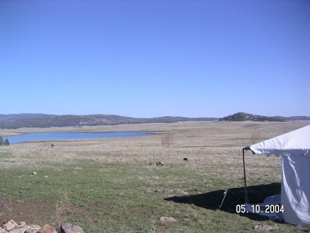
Last weekend John, Kip, and I traveled to Arizona for the rogaine World Championships, an event we have been looking forward to since its announcement in 2002. The idea is simple - 24 hours, accumulate as many points as you can by locating checkpoints scattered around the map. The event was held in the White Mountains of eastern Arizona at 9000 feet elevation, in beautiful pine forests and open fields, over rolling hills and through drainages and creeks.
We camped with Scott Appleton and Sheila Torres-Blank, also meeting our friends Steve Daniel and Shaun Bain before and after the race. There were many other adventure racers there, and it was fun to meet new people and talk with folks we had not seen in quite a while. Our training for the rogaine included the Vermont 100 last summer and more recently several long (12, 24 hour) hike/run workouts. We did many running workouts with a focus on hills and leg strength. Each workout helped us refine our strategies and our gear list. We carried as little as possible, but enough to stay on the course the whole 24 hours without returning to the hash house (the start/finish). If nothing else, the lure of hot food and chairs in the middle of the night would slow us down. The main weight in our packs was fleece tops to stay warm in the freezing night air and many packets of SPIZ that we mixed and shared every hour. Plus one luxury item, a bright light to assist in nighttime navigation. Our main concern was the effect of 9000 feet of altitude. None of us were able to train that high, although previous races in Colorado showed that we didn't have any obvious weaknesses in that area. It's just hard to tell how close to your limits you can push without a lot of experience in those conditions. During the 3 hours with the maps on Saturday morning, we discussed route options and measured distances. Our goal was to cover at least 80 km, and it was immediately clear that hitting all the points would not be possible. We wanted to get the high-valued points in three of the four corners of the map, leaving a couple valuable flags in the northwest corner since they were rather isolated. The middle of the map also had some valuable checkpoints, so we tried to plot a route that hit most of them. #82 and 84 would have required a lot of elevation gain/loss, so we opted out of those along with some of the 40's and 50's. The distance target was based on going uphill for an average of 300 feet an hour, but I had difficulty estimating the elevation numbers for our intended route without spending a lot of time on the analysis. The number of contours did not look imposing, and it turned out to be a rather flat course compared to much of our training. We decided that the high elevation might counteract any gain we would get out of a flatter course and so we kept the 80 km target.
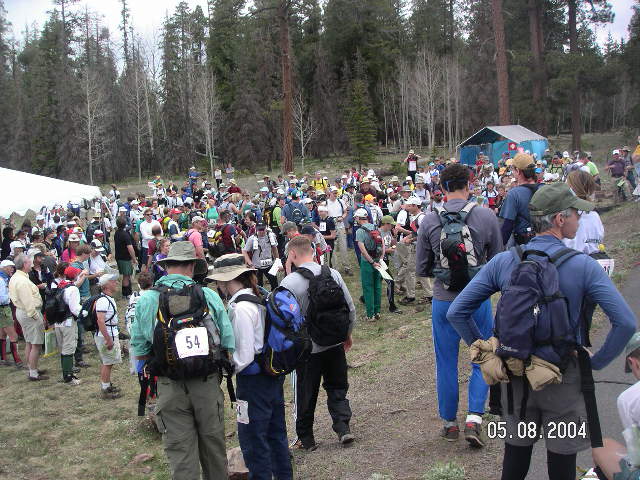
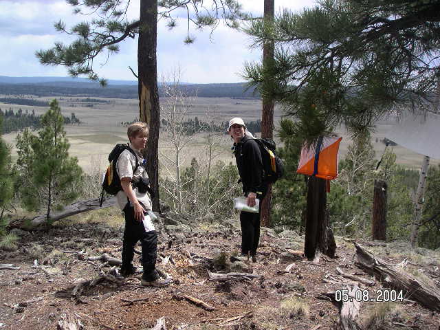
Each team picked up their control card at 11 a.m. and then we were off! Off to a fast start, walking uphill from the control card table to the park road. And we were immediately out of breath. The effect of the elevation was obvious. On the flat road we jogged slowly, picking up the pace to move downhill and across the main road. The three of us navigated together through the woods to #40. It was important to get calibrated to the map and the contours, so we focused on distance traveled and the shape of the hills. We had never done precision navigation on a 40K:1 scale map before, but our worries about not being able to see enough detail were unfounded. It was an excellent map, very well drawn. As someone remarked afterwards, there were a lot of things that did not appear on the map, but everything that we needed for navigation was there. We went over a faint saddle, through the top of a slight drainage, and then down on a compass bearing directly to the field where the point was located. Success! After that, we rotated primary and secondary nav duties, with one person just following along (or helping make a decision when the two navigators were at an impasse). John led us along a road and up a hill to the #73, and then I took us north and down to a creek. In our first experience following a creek we determined that sometimes it would be difficult (rocky and slow) and sometimes easy (on a flat field or even a small animal trail next to the water). We stopped briefly for SPIZ and for Kip to put some additional blister-avoidance duct tape on one foot, then we jogged to #83. Kip navigated along trails to #96 while John assisted, and I enjoyed relaxing my brain. John towed me up the short hills which helped a great deal, as I could control my breathing better with help. I was definitely affected by the altitude on the uphill grades, but we maintained an easy pace most of the time to prevent later bonking. Along the north part of the map we enjoyed moving quickly on mostly flat area. We were surprised to be the first team at two of the controls, something we thought would not be possible this time based on the size and strength of the field. Apparently the wide choice of routes had well scattered the teams. Suddenly some elk crossed the path ahead of us, looking at us with worried expressions. I imagine they were trying to figure out where all these people were coming from, but at least they were headed in the right direction - off the map. Very cool animal sighting. Throughout the 24 hours we also saw deer, chipmunks, squirrels, and a rabbit that tried to hide by sitting really still. From #96 we jogged to #66 with a short unintended detour to "avoid contour lines", then I took the lead on trails and contours to find a magnificent view at #97. A wide open field lay to the south, with many large trees and forests beyond. I always appreciate it when a race director leads you to a great view.
We ran down the hill and across the first part of the field to #77 where we refilled our Camelbak bladders. We brought water treatment pills but never used them (8 water stops!). Quickly we got everything back in place and headed east. John chose a good path through the woods to the marsh by #58, then luckily I was navigating next or he might have tried to take us through the marsh to the road. Instead we went around the water, then found a minor drainage on the other side of the road and jumped on a trail most of the way to #98. First corner done, yay! We noticed an unmarked trail going south from there, so Kip decided to use it. We stopped briefly for SPIZ and then ran downhill through the woods until we reached the clearing below #57. The spur in the woods across from us was not immediately obvious, so we stopped for a minute and Kip and John made the assessment that it should be there. Into the woods we went, and John towed me as we found the spur right in front of us and the point right on top. Very nice. Heading along the field toward #89, we saw a couple other teams way in front of us. The distance across the fields could be deceiving - on a 40K:1 map the open spaces don't look too big, but in reality they are huge and the other people looked small. But we were moving well enough, and it didn't take too long to reach the next little climb up to the checkpoint. John took a brain break while we climbed west toward #94 and Kip and I discussed the next point. We decided to follow the long rather-narrow nose toward the road, and then take the trail until we were right over the point. I drifted a bit far south (we'll call it "aiming off"), so we had to come back up the road just a hair before heading off toward the trail. Kip and I must have described the route well enough, because John led the way to the trail without consulting his map. We ran down the trail and talked about adventure racing, a rather apt subject because I had chosen to go the direct route on the trail and then down a steep drop to the point instead of taking a parallel and possibly slower route down a long drainage. I'm getting better at dealing with steep slopes in anticipation of future adrenaline-inspiring adventure races, and had no trouble picking my way down these tight contour lines. At the bottom John called "point!"
Kip took over next and we climbed slowly south toward #76. Kip climbs well and John has tons of strength, but even on tow all of my limited oxygen went to my legs. Luckily I didn't have to think at the same time, and Kip's nav was good as we headed over the saddle. Finding the trail and a downhill slope on the other side, I immediately felt better. Suddenly, another sighting - not elk this time, but a team in red jerseys, RUNNING UPHILL. John recognized them as Michael Tobin and Mike Kloser, adventure racing champions and eventual winners of the rogaine. I grabbed the camera and got a couple pictures as Kip and John gushed to them that we are huge fans. They shook all of our hands and were very gracious with their time in the middle of the race, then we waved good luck and let them go. Wow, that was cool! We sometimes race on the same course as the gods of AR, but once the gun goes off we almost never see them until the finish line. Rogaining is a great sport :)
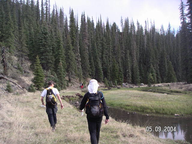
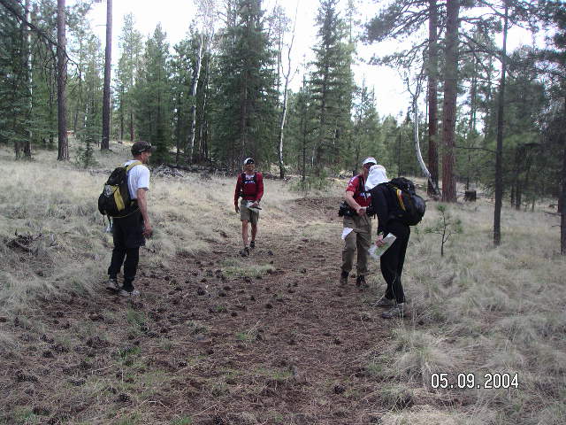
We recovered from our amazement enough to navigate to #76, and then John took over for #87. We saw many other teams in this stretch, including a co-ed team that looked to be moving quite well (I think they ended up in second place). There was enough water left at the checkpoint to top off our bladders, and we went off on a southeast bearing to get down to the creek below. Another team was coming down the drainage from the east as we started walking up. Along a flatter stretch, John's SPIZ timer went off and we mixed and drank it before starting up a steeper section. John towed me and I called off instructions as we walked - follow the trail until it turns, then head north toward the saddle, then go to the right, up 1-2 contours to find the second hilltop... point! Kip took us southeast toward the next open space and I put my body on autopilot for a little while. We saw a team of 3 running down a road in the distance and I theorized that they were one of the top co-ed teams. We climbed up a short, steep hill to #69 and then kept going to the trail. The team passed below us in the woods and I never got a good look at them, but they were moving well. John followed trails and open spaces toward #99, changing strategy on the fly and heading down to the creek as soon as we caught a glimpse of it. We followed the creek, crossing fences at regular intervals. The fences had greatly frustrated us 3 years ago at the Mogollon Rim rogaine, but this time we were mentally prepared and just dealt with them. After a short climb up to the checkpoint that marked our second corner of the map, we turned southwest and gazed across the wide field. Kip and I had decided to alter our intended route of 99-49-78, and instead went from 99-33-78. In return for losing 10 points we had easier nav and fewer contours. We hoped we would gain some time that could be used later to gain more than 10 points back. Night crept in as we reached the trail on the south side of the field, and John handed us our headlamps. #33 was an easy climb to follow a fence to the point, then Kip and John discussed trail options to the next point. As we gained the road, Kip thought we were going right, John started left, then they said "let's just decide!" so I jumped in and claimed the northern route. Fewer contours, always my preference. Kip easily got us to the reentrant and John used the big light to locate the point above us. Then it was John's turn to get us to #68. There was a minor obstacle in between us and #68, namely a canyon. Not a huge one, to be sure, but the sides looked a bit steep. John led us on a good bearing that got us to the edge at a place that was slightly less steep, and going down was pretty easy. We hit some brush at the bottom and had to hop a couple rocks to maintain dry feet, but it didn't take long and then we were looking upward at a large rock field. No real way around this part, so it was on tow and up we go. The rocks were mostly stable and mostly large, requiring big steps. We stopped a couple times for short breathers, but I got a tad uncomfortable as we went higher so I was OK to start moving again without much delay. The top was abrupt, and then we were on a flat plateau and a trail. Just a slight drop down a drainage to #68, where we filled the bladders again. I was on primary nav duty next, so I took us down the drainage, looking for a T into the main creek. We were talking about something or other, and I missed this spot. I got concerned about our location as we moved further down, and I tried counting paces as we clambered over rocks and branches. Then we hit an intersection and I couldn't figure out which one it was. The compass and the big light didn't help, and against Kip's suggestion that we had just found the spot where we should climb out of the drainage, I had us continue downstream. Many minutes later we found a larger intersection and it was quite clear we had gone too far. Distance-wise it was not a big deal, we just had to climb up the side of a hill, but it was a lot bigger climb than we would have done on the correct route. That plus the added time working our way down the creek bed, perhaps 30 minutes lost in total. Sigh! John said "No matter, let's go" and pulled me up to the trail. Finding #88 took us just a little bit of time, as we explored along the top of the cliffs until we were at the southern end of the plateau and there was the point. I don't remember much about the trail to #56, I think I was giving myself a mental talking-to. Kip cut across the woods to hit the point from the east, saving us some climb, and we found the point in the drainage above us. I think we saw another team here, but at night everyone else was mostly a dark figure with a beacon of light on their head trying to keep moving until sunrise. The next part is clearer in my memory, partly for being backup navigator and partly because we crossed an open field and it was dang cold. I was wearing just a poly pro and Rail Riders shirt at this point and wondered if it was time to break out the fleece. We splashed across a marshy area and found the drainage to climb on the other side. Once we were going uphill I warmed up again, and our feet dried quickly even at night. John followed trails around to #93 and then I took over navigating. We cut across northwest on a bearing, and then followed trails around the tops of drainages. We finally found the one we liked and jumped down it to locate #63. We quickly refilled the bladders, getting just a little chilled from sitting in one place, then we jumped up and continued downhill. Kip and John talked while we headed west, working on a route from drainage to drainage, trail to trail, over a hill and down to the trail leading toward #90. I tried to keep up on the shallow uphills and also tried to eat something. Neither was working too well. We located #90 with the help of the lights from a team who got there ahead of us. On the way back to the trail we took a quick bathroom break. I was glad for the rest so my stomach could settle a little. Our liquid diet of hourly SPIZ was working well for me, but my stomach was starting to complain when I added anything solid in between. At least calorie intake was not a problem for me like it had been in previous long races. Kip was having the opposite problem. Solid food, his mainstay, was still good for him, but his body was rejecting the novel idea of frequent SPIZ. Our one big strategy mistake was not considering that this might happen, not having him test it like John and I had done during training. So Kip stopped drinking SPIZ and he happily took my bag of sugar cubes that was no longer helping me. Next up, #61 on trails. We ran past the left turn we were looking for without seeing it, but I stopped John a few feet later to ask about our direction of travel and with only a slight pause we were back on track. If only I had reacted as well to Kip's double checking a couple hours earlier. The trail turned into a raised railroad grade without train tracks. It was interesting to be running on a raised bed with slopes down into the trees on either side. We stopped in our tracks upon finding a gate barring the way onto a section that looked like a high bridge. OK, so the gate wasn't going to stop us, it was just a bit weird to see a straight trail heading into the darkness with steep, long drops on either side. We ran across, musing about what it would look like during the day. Snow still covered parts of the ditch that we crossed to climb up to the saddle and find the point. It was getting quite chilly, especially when the wind kicked up. We started a long, long run/hike over to #45, about 4 km on easy but boring trails. In retrospect, #42 would have been an easy detour and a welcome break to the monotony. Ah well. Partway along I was cold enough to put on my fleece, much better. The weight of nighttime dragged on us and our pace slowed. Our brains slowed through lack of use, we got quiet, and everything sort of lagged for a while. As we neared the point, it seemed to take too long even though I had started pace counting (if nothing else than to keep up my concentration) and I thought I had an accurate distance estimate going. Finally! There appeared the bend in the trail, the little creek, and the "golden" spur. John led the charge to the point and then Kip took over to lead us down the hill toward #52. Stomach rumblings prevented Kip from running downhill, and I started calculations about our chances of getting to the southwest corner of the map based on our current speed. My reverie was interrupted by a loud, rushing creek that we had to cross. No bridge on this trail. The guys located a large tree that had fallen over the water and John jumped on it to scamper across. It rolled a bit while he moved on it, so I sat on it for Kip to traverse. John turned to ask me if I wanted to take the high route, but I was already splashing through the water toward him. I wasn't worried about wet feet this far into the race, but my goodness that water was COLD. My feet started thawing right away as we climbed up the hill to the point. The sky was clearing upon our return to creek level. Another team passed us going up, and they grunted in answer to our greetings. I understood, as I'm not usually much of a morning person either. Although I must say, some of our best mornings happen after we have been racing all night. Sunshine! We climbed up to a pretty meadow and follow the edge of the trees to #81. Our talk now centered on how to approach the final 6 hours. All along I had hoped to be able to push hard on Sunday morning, and Kip was game to try it. He did not feel well but he thought he could keep moving at a decent pace if he could concentrate on recovering from his stomach problems instead of navigating. John and I took over on the maps, no problem. At the control point we stopped to reorganize, listening to the calls of wild turkeys nearby. I put water in my handheld bottle and gave my "special treat" Gatorade powder to Kip for his Camelbak. John rolled up my pack and stuffed it into his. We looked for food that Kip could stomach. And we decided to try for #91 and hope for the best in getting back to the hash house by 11 a.m. Trying the southwest loop while Kip wasn't feeling well made me a bit nervous. This gave me a boost of adrenaline (plus I was cold from sitting still), so we started south at a quick pace. Being able to see everything around us again was a happy event. We headed down to a creek and then straight up the other side. We didn't follow our location on the map very closely, so when we popped out at the next large meadow it took us a second to get our bearings. Quickly we realized that our sense of scale in open spaces needed to be recalibrated again - the field was huge (1.5 km across) and we were small specks in one corner. We explored the edge of the woods until our calibration was complete and we spotted #91 across the way. And then we were off! Kip was moving just fine and feeling better all the time. We jogged directly toward the marshy area to the west, to heck with wet feet now. Splash, splash. We field-hopped our way to #48 at a good pace. Just before the point we stopped to speed-strip and dump clothes into John's pack. Kip did a bit of foot taping, John and I downed some SPIZ, and we were moving again. Phew, it felt good to be free of the winter clothes. We tagged the point and I announced that I had a plan to get us to the finish on time for sure. We would skip #85 and head directly to #92, and then if we still had time near the end we had other options to get more points later. So we climbed up to the road to the west and walked/jogged to the jump-off point to #92. On the way downhill Kip slowed to protect his sore feet, then on the next uphill I slowed to catch my breath. My legs felt OK, but 2 nights are not enough to acclimate to 9000 feet elevation. John towed me as we worked our way around a couple rocks to find the control. My turn for #75. We started on a plateau and I tried to follow trails going north. Jeep tracks went different ways, so I relied on the compass and headed generally north/a bit east along the easiest route to follow. I finally found a long fence next to a trail that seemed to match the one on the map I was seeking. When the fence curved, we headed north and down the hill. Flies were abundant so we didn't stop much in this section. I was relieved to find a field, verifying our position. I headed down a drainage and then we emerged from the trees to see the checkpoint. Except it was on the opposite side of the valley and up a cliff full of huge rocks! That was pretty cool. We marked the position from the road and then began a slow climb. Reaching the rock pile, I got off tow so each of us could pick our way up. John leaped enthusiastically from rock to rock, Kip followed proclaiming how much fun this was, and I concentrated on not slipping into the cracks in between the boulders. They led me up a good route, so all I had to do was balance, both on my feet and also between going too fast for my breathing vs. as fast as possible to get it over with… There was a great view at the top, so we took a second to admire it, and then it was time to vamoose. We headed north and down to the road where we could see teams going south. From there until the end we were in the big open area on the west side of the map, and we were in the company of many teams going many directions - some much faster than others. We gradually became one of the slower teams. We followed a meandering creek around to #80, walking through it several times to keep a straight line. I splashed water on my face and arms to stay cool under the bright sun, and John loaned me his sunglasses. The tufts of turf made it a bit difficult to move forward efficiently, but soon we were at the control. We decided to head to #71 and then figure out what we wanted to do between there and the finish. Time was counting down, but at least we had plenty of it to spare now. It was a long slow walk up the hill to the east. Kip's legs were not responding, and mine were not upset at all at our change in pace. We had dealt well with the altitude but perhaps it was finally wearing us down. Or maybe we were just tired. When we reached the top we could see the hash house WAY in the distance. That was a bit deflating for our weary minds and bodies. We punched #71 and decided to just get #30 on the way back so we didn't have to sprint for anything. We put Kip on tow and started walking south at a decent pace, getting in line with other teams doing the same thing. I tried to guide us through the smoothest, least-tufted animal paths and we maintained our patience even as the hash house seemed to maintain its small size in the distance. #30 was a short climb and a minor party with several other teams, then we were skirting the shallow drainage ahead of us, crossing a couple last fences, and suddenly we were done. Yay!! We finished at 10:20 a.m. with 2460 points (8th place co-ed out of 69 teams, 3rd US co-ed, about 85 km traveled) and only a minor regrets about not trying for an additional control somewhere along the way. Of course, minor regrets over time become huge motivators that bring you back to the next rogaine hungry for more. ;-) Overall, we very much enjoyed the course, the setting, the challenge, meeting all the neat people, and having the rare chance to run a rogaine. Thank you so much to John and Peg and everyone who organized the event! Y'all are the best! Our biggest upgrades from previous rogaines:
|
Back to Team Vignette's race history page
Back to Team Vignette's main page